|
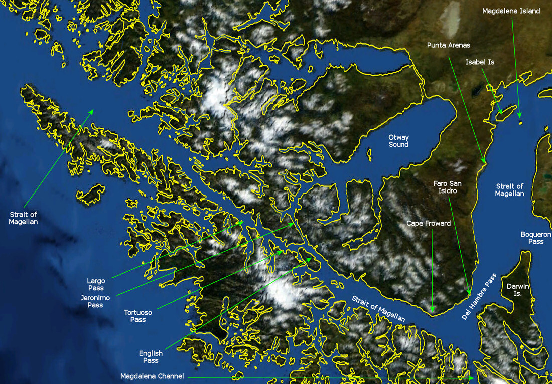
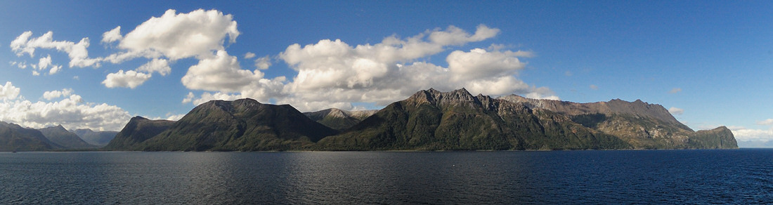
The map below was generated using
NASA's World Wind v.1.4 software showing the region of the Straits
of Magellan from just east of where Punta Arenas is located on
the Strait to where the mouth of the strait opens to the Pacific
Ocean on the west. The map extends to the south to just
where the Magdalena Channel enters the Straits of Magellan south
of the Del Hambre Pass. Our route brought us through the
Magdalena Channel and north to Punta Arenas, Chile. From
Punta Arenas we again turned south sailing back down the channel
and around Cape Froward, the southermost point of the continent
of South America where the Cross of the Seas stands atop the Cape.
We continued to the north west through English Pass, Tortuoso
Pass, Largo Pass, and out into the open waters of the Pacific
Ocean. The place names on the map below were hand inserted
and are referred to for some of the photos that will follow for
this segment of the trip.
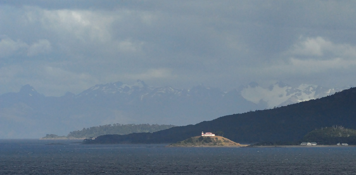
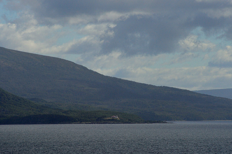
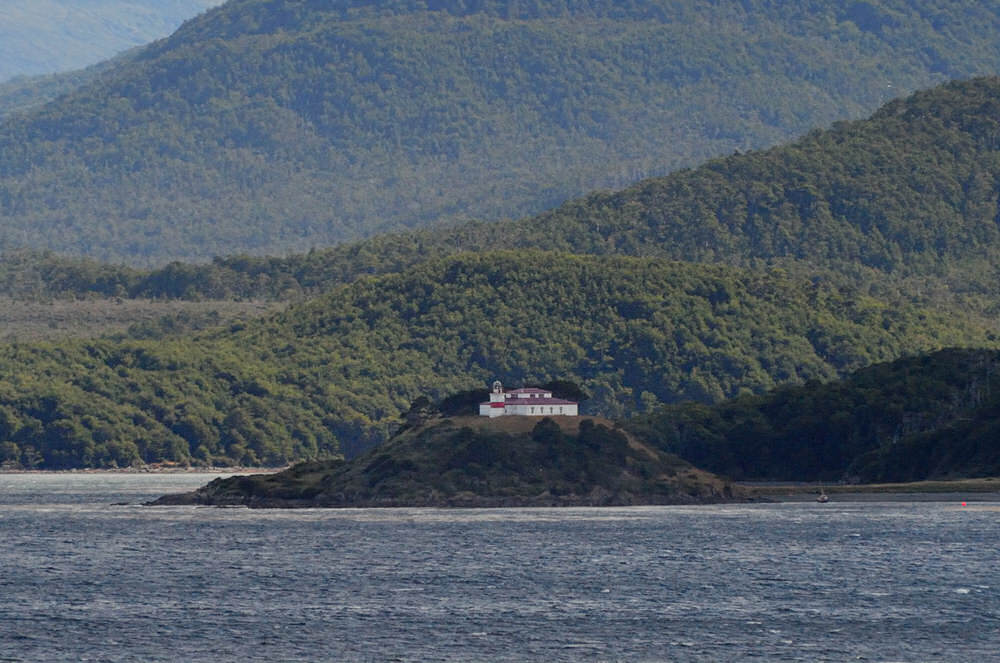
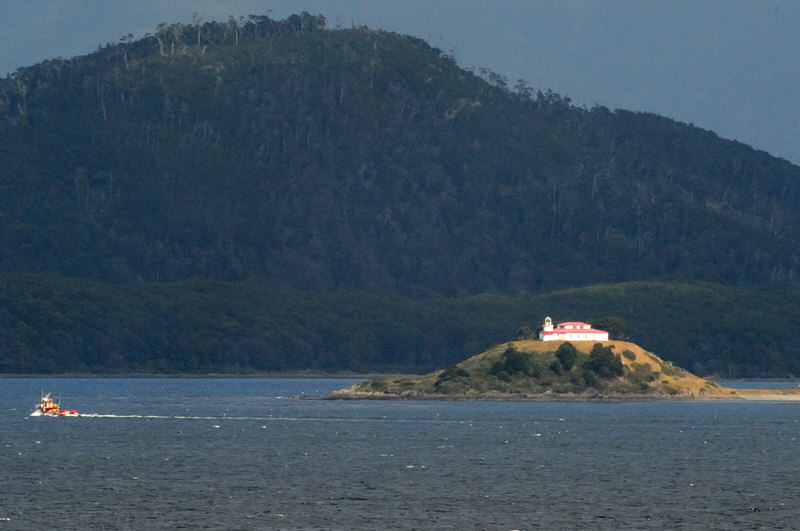
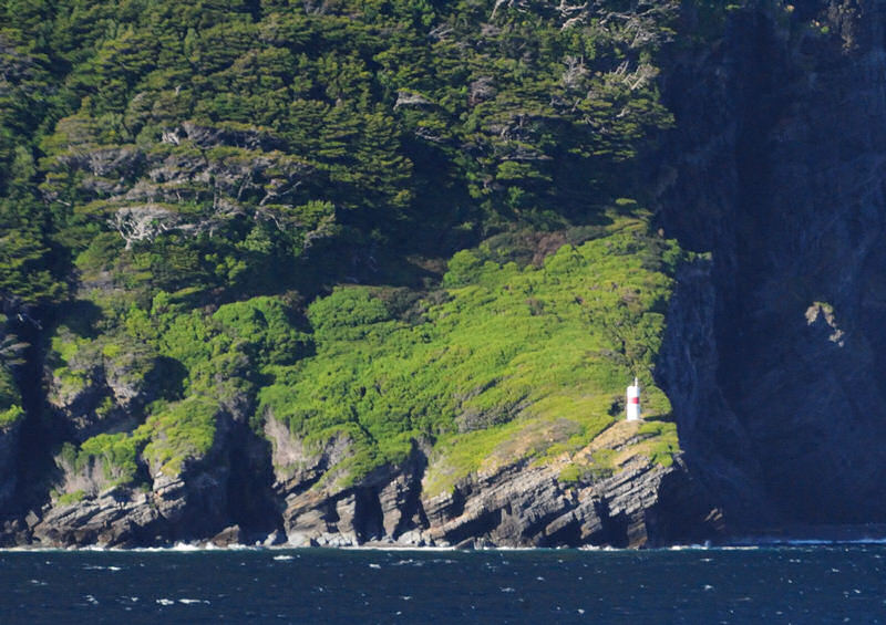
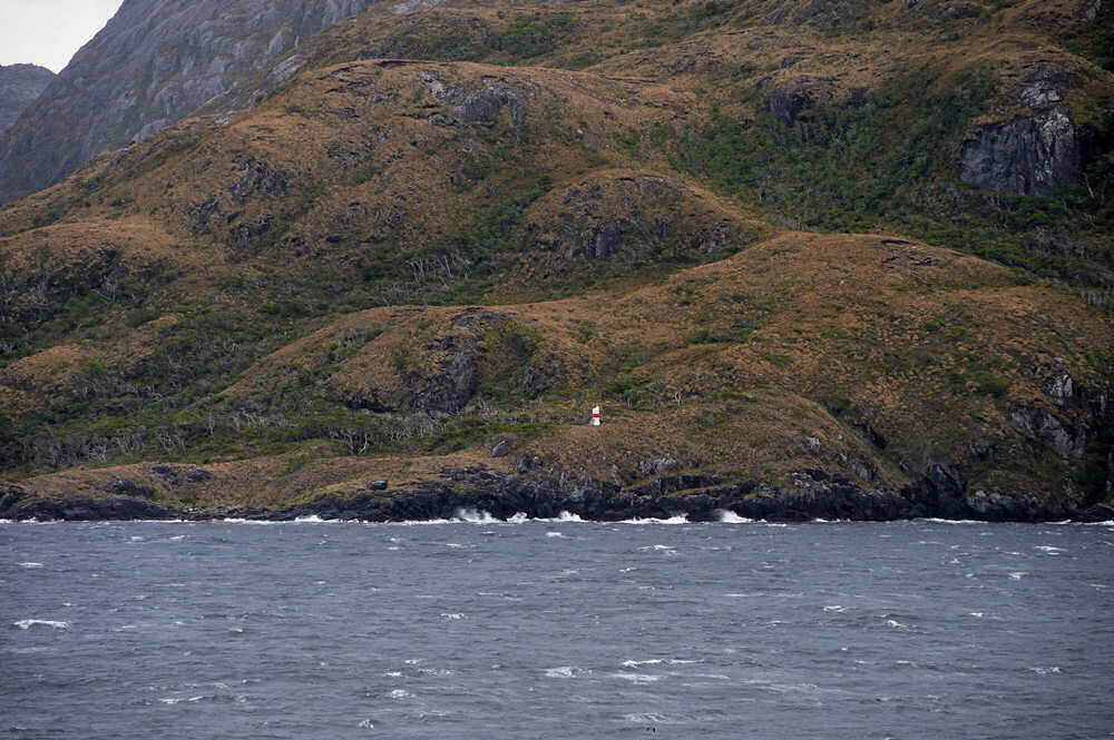
One of the Chilean lighthouses
that we sailed past both going north to Punta Areans and
then again when were were heading south toward Cape Froward
was Faro San Isidro. The lighthouse sits atop a
small island off the north shore of the Strait of Magellan
in the Del Hambre Pass not all that far from the town
of Puerto Del Hambre. The lighthouse consists of
a white keeper's residence with an attached tower with
a horizontal red band around the tower. The station
appeared to be well maintained when we sailed past it
in February '09. It was convenient, too, knowing
that we'd be sailing back past the lighthouse again later
in the afternoon when the light would be different.
|
click image above for a larger
view
|
click image above for a larger
view
|
click image above for a larger
view
|
click image above for a larger
view
|
click image above for a larger
view
|
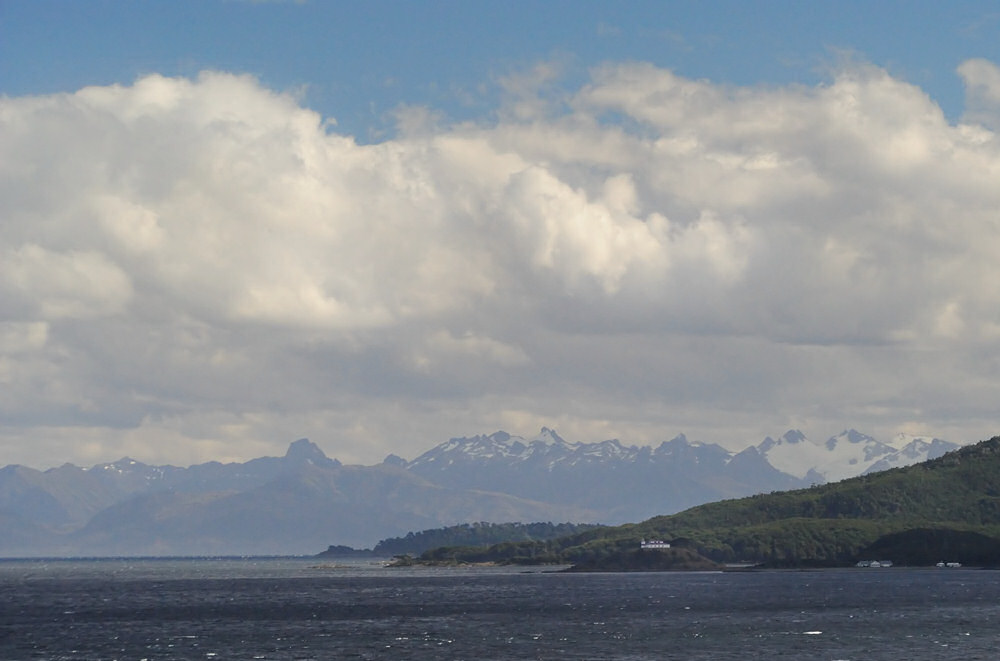
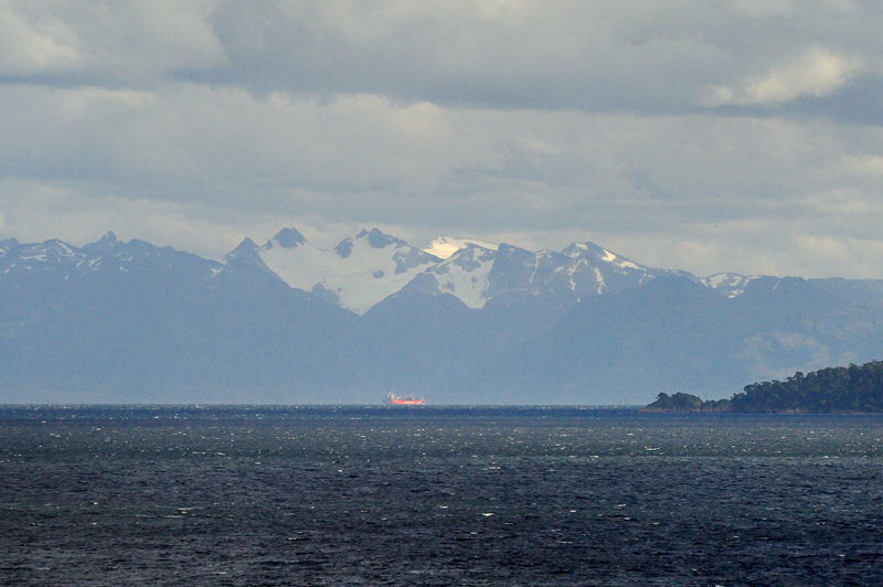
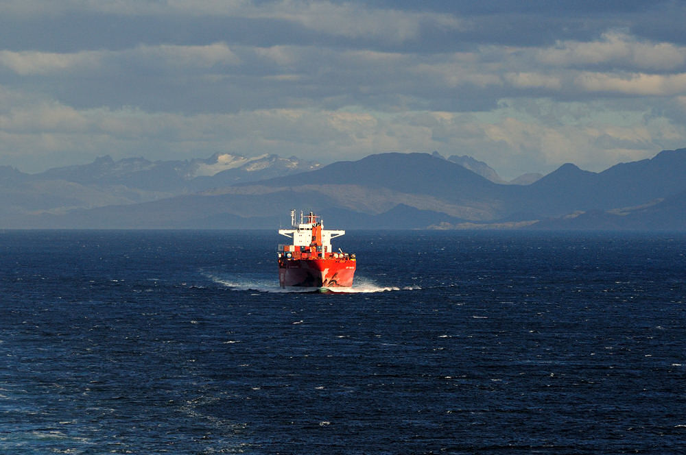
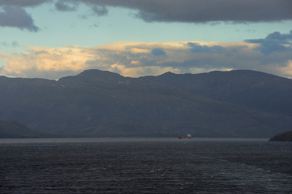
Later in the afternoon,
as we were headed for Cape Froward, in the distance ahead
of us we could see a freighter headed west in the Strait
of Magellan. Much later after we had rounded Cape
Froward, we overtook and passed the freighter as we were
approaching Paso Tortuoso. A shot of the frieghter
in the distance ahead of us is shown below.
|
|
OK, so this segment is
redudant and repeats some of the images contained on the
Ushuaia - Punta Arenas page, but it seemed to make sense
to do that since we could only see Cape Froward distantly
to the northwest when we came out of the mouth of the
Magdalena Channel when we were north bound toward Punta
Arenas to clear Chilean immigration and customs.
|
click photo for a larger view
An annotated version of
this image is also shown with the larger view.
|
click photo for a larger view
|
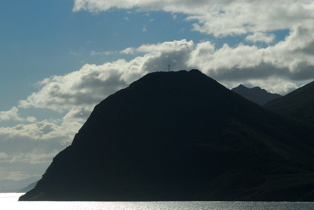
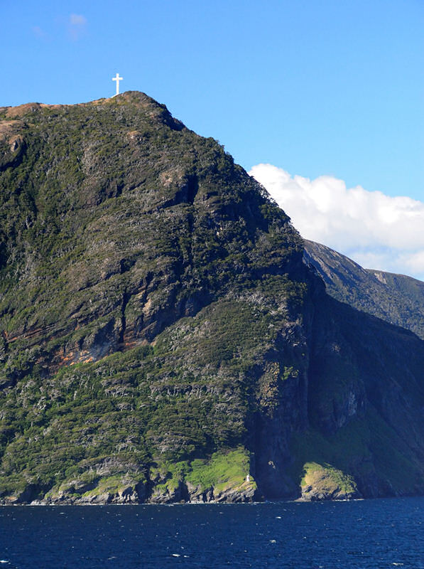
Approaching Cape Froward
in the late afternoon is an unusual time for a cruise
ship to be passing the southernmost point of land of the
continent of South America. Generally, cruise ships
that arrive in Punta Arenas in the morning are busy with
shore excursions until late afternoon and they tend to
round Cape Froward around twilight or later. Consequently,
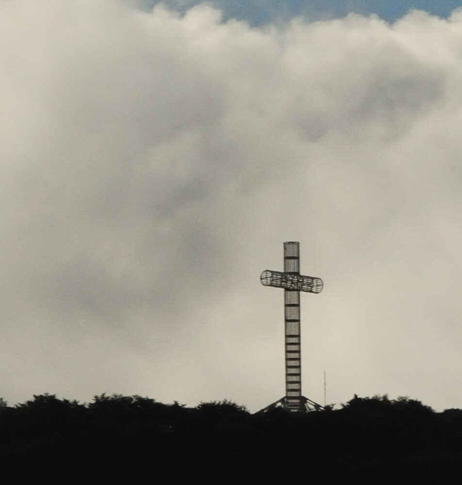
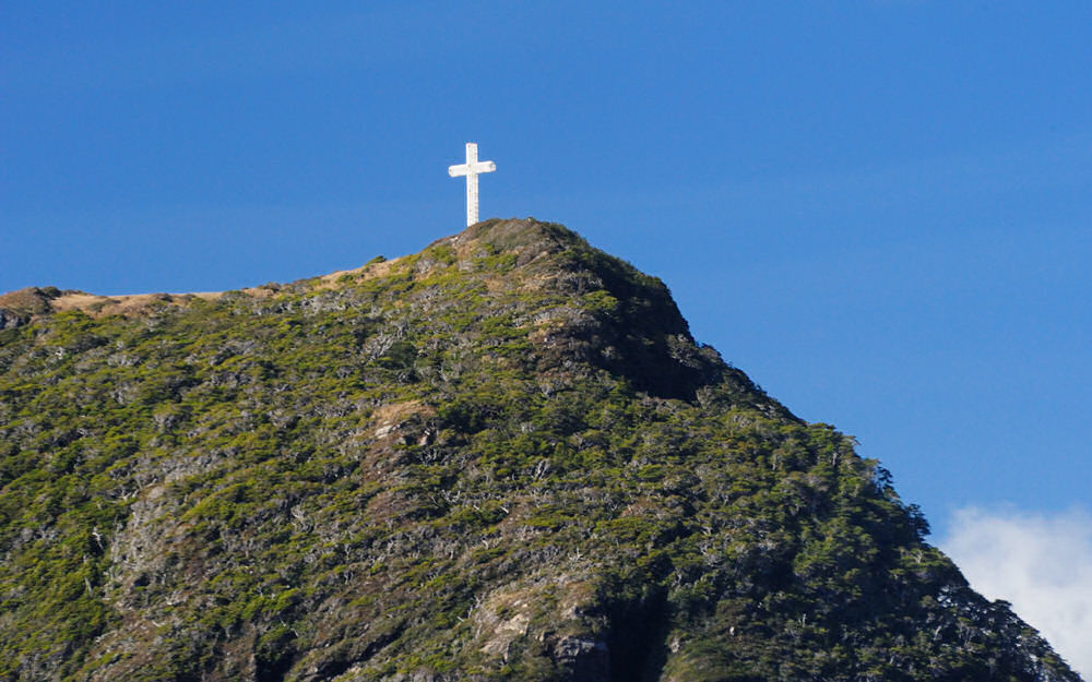
we had a treat in getting to see the third Cross of the
Seas that stands atop Cape Froward in the bright light
of day. The photo to the left shows all of Cape
Froward silhouetted in the late afternoon. The tiny
Cape Froward light that marks the tip of land is barely
visible against the brightly reflecting waters of the
Strait of Magellan in the photo to the left above.
The right image is a 600 mm telephoto shot of the Cross
of the Seas showing the open steel skeleton of the cross
that allows the strong prevailing westerly winds of the
region to blow through the structure of the cross.
This is the third and
and largest cross erected atop Cape Froward. It's
worth recounting a bit of the history of the Crosses of
the Seas here. The first was constructed of iron
and was erected and commemorated in December 1913 to celebrate
1600 years since the Edict of Emporer Constantine who
granted Christianity religious freedom in the Roman world.
The force of the winds, however bent and broke the first
cross, which stood 9 meters (~28 feet) high, in 1930.
The second cross was commemorated in March, 1944 and was
21 meters tall and built of reinforced concrete.
It was constructed to commemorate the choice of Punta
Arenas as the base for the Ninth National Echaristic Congeress.
Again, due to the strong prevailing winds and earth tremors,
the 2nd cross collapsed in 1956. The present cross
was erected to commemorate the visit of Pope John Paul
II to Chile in 1987. The current Cross of the Seas
stands 24 meters or 79 feet tall with a crosspiece position
north to south that is 10 meters (33 feet) across.
The diameter of the cross piece, to provide a sense of
scale, is 2 meters or ~6.5 feet. The present cross
is a circular high strenth steel lattice designed to allow
the winds to blow through it. Hopefully, this magestic
marker of the southern tip of the South American continent
will last considerably longer than its predecessors.
|
click photo for a larger view
|
click photo for a larger view
|
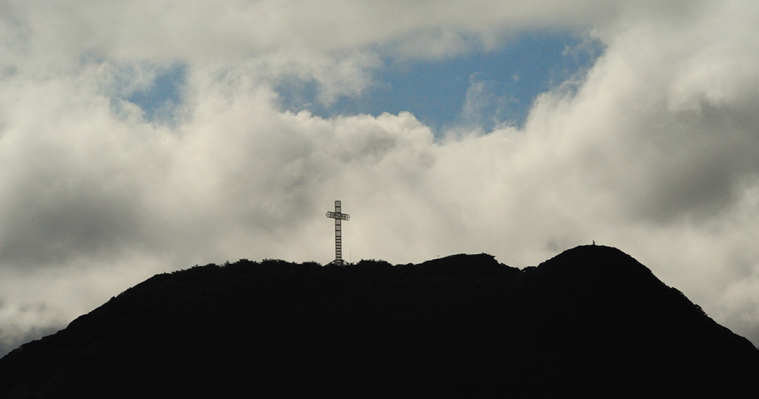
Cape Froward
|
click photo for a larger view
|
click photo for a larger view
The small Cape Froward
light marks the tip of South America along the north shore
of the Strait of Magellan. The Cross of the Seas
is seen standing atop Cape Froward in the image to the
left.
|
|
The wide angle view
above was shot with a Nikon D3, the sensor in the FX mode
at a focal length of 17 mm and shows the region near Cape
Froward (extreme right point of land) from the southwest.
|

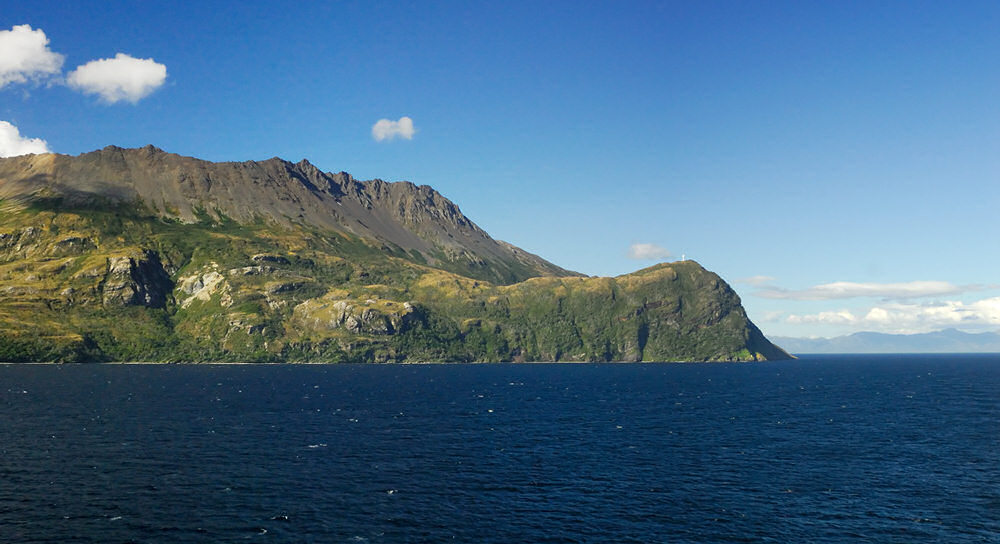
Obviously, all of
the photographs shown above were shot in the Straits of
Magellan. The segment of the Strait northward from
the mouth of the Magdalena Channel to Punta Arenas and
then back south again and around Cape Froward, however,
is such a broad, wide body of water that to my mind it
hardly seemed like what the word "strait" conjurs.
That said, after rounding Cape Froward and headind west
north west toward Ingles Pass or Tortuoso Pass, the nature
of the Strait changes somewhat and narrows considerably.
The images and segment which follows is from that narrow
segment of the Strait. These images were shot as
a strong storm was gathering that we were sailing toward
as we made our way westward in the Strait toward Cabo
Pillar, which marks the southern tip of the western terminus
of the Strait of Magellan. When the Splendor entered
the open waters of the Pacific Ocean around 2300 hrs that
night, it was into 90-100 mph winds and seas that were
running 20-25 feet. The stability of the Splendor
was truly amazing despite the seas that we were in.
It was interesting to ride in the elevators on the ship...
periodically as we would rise and the slice down and through
a big wave there would be a very deep, resonant bass boom
up through the elevator shaft from the hull. I truly
wish it had been daylight when we made this part of our
passage so that I could have seen the waves and Cabo Pillar!
|
click photo for a larger view
|
click photo for a larger view
|
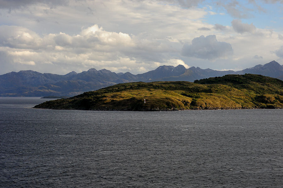
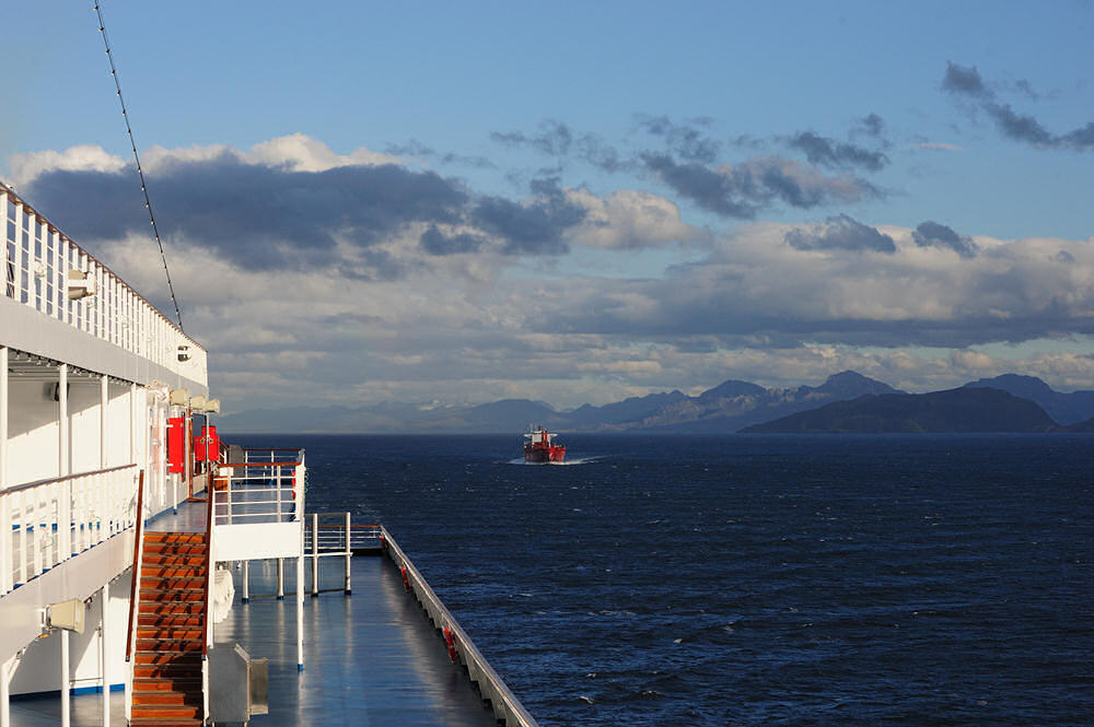
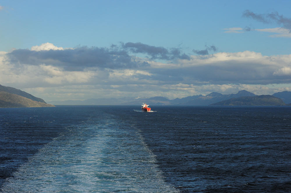
As we slid by Isla
Carlos III, there is a small channel light to mark the
island for ships heading east through the Strait.
We were in the Ingles Paso (English Pass) when we caught
up with the freighter that we saw making her way toward
Cape Froward earlier in the day. The sequence of
three photos shown here were taken within the span of
probably on about 5 min, which gives you an idea of speed
we were moving at vs. that of the freighter. We
passed another small channel light within the Tortuoso
Pass; after we were through Tortuoso Pass, looking back
you could see the freighter making her way around one
of the points of land that defines the pass.
|
click photo for a larger view
|
click photo for a larger view
|
click photo for a larger view
|
click photo for a larger view
|
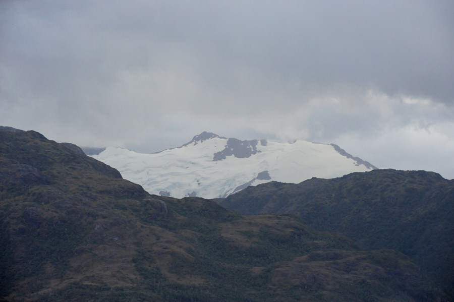
Looking up, there
were hanging glaciers, and looking forward you could see
the ominous weather system we were sailing into as we
made our way further west in the Strait. Not too
long after the photo on the right below was shot, it began
raining pretty hard, and the rain didn't let up that I'm
aware of as daylight faded away...
|
click photo for a larger view
|
click photo for a larger view
|
|
|