|
Our departure
from Ushuaia was scheduled for 1600 hrs but unfortunately,
the winds were running 40 knots across the Beagle Channel
from the southwest keeping the Splendor pinned tightly
against the pier since we were moored on the south side
of the pier. The Captain and the pilot did not to
risk doing any damage during departure and elected to
wait until the winds died down. Our route was going
to be west through the Beagle Channel past a number of
glaciers that flank the channel in valleys to the north
of the channel. Seeing them and having the opportunity
to photograph them would have been a treat but, sadly,
that was not to be. As it was, the winds were slow
to die down and we didn't end leaving the pier until 2230
hrs. We headed eastward to Faro Les Eclaireus and
turned to starboard around the lighthouse to get into
the deeper waters of the Beagle Channel used by ships
transiting the channel to the Pacific Ocean. It
was nice to watch the white flash from Faro Les Eclaireurs
from our balcony as we turned around it. Unfortunately,
aside from seeing the lights or Ushuaia from the water
as we were going west past the city, there was essentially
nothing else to see other than the blink of the fiberglass
tower at Zeballos every 4 sec marking the boarder between
Argentina and Chile on the north side of the channel.
|

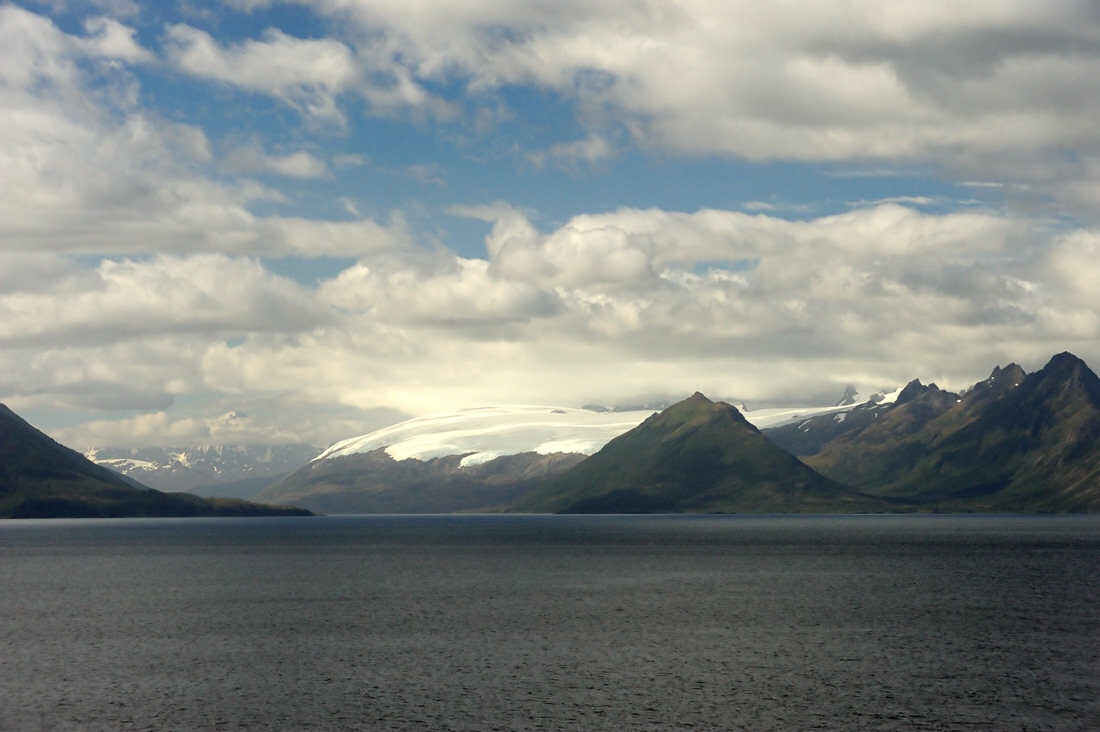
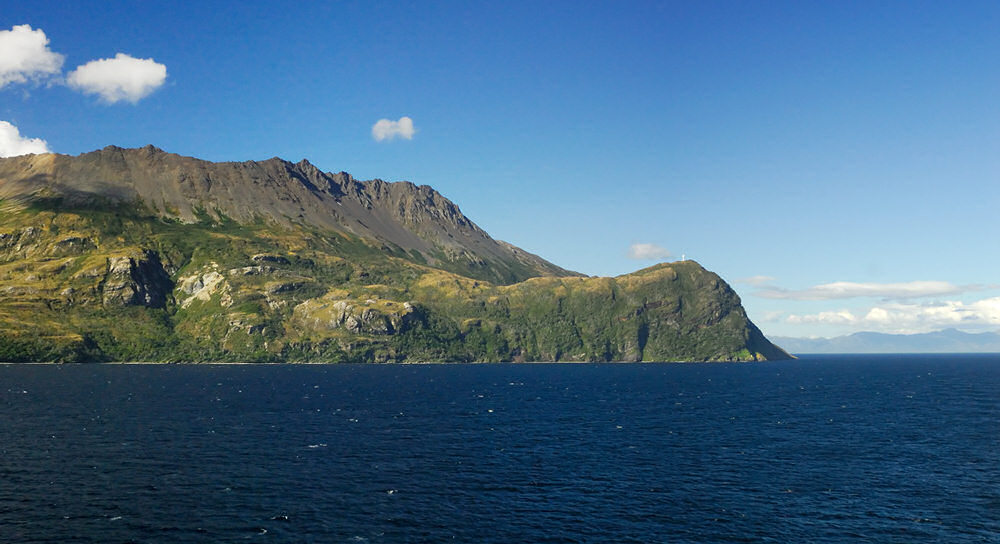
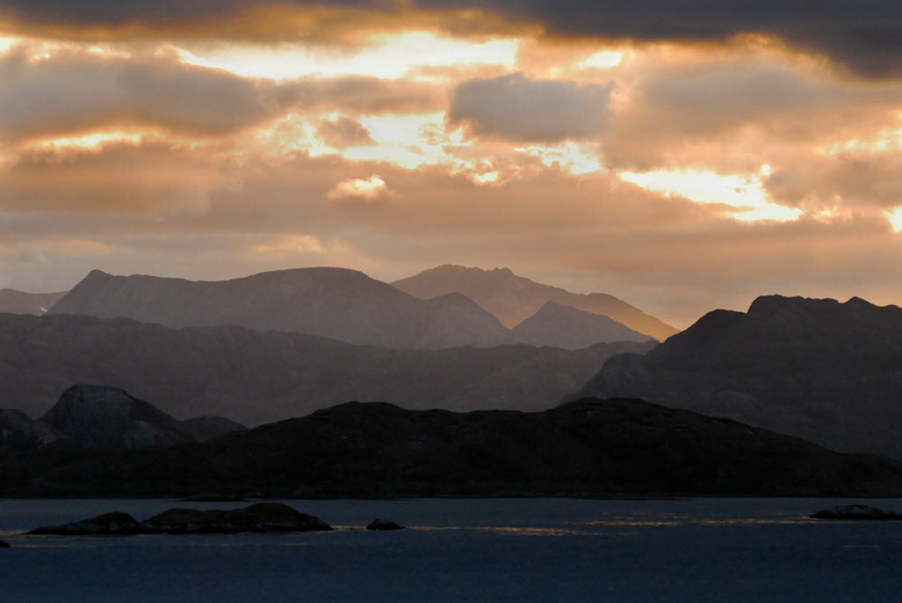
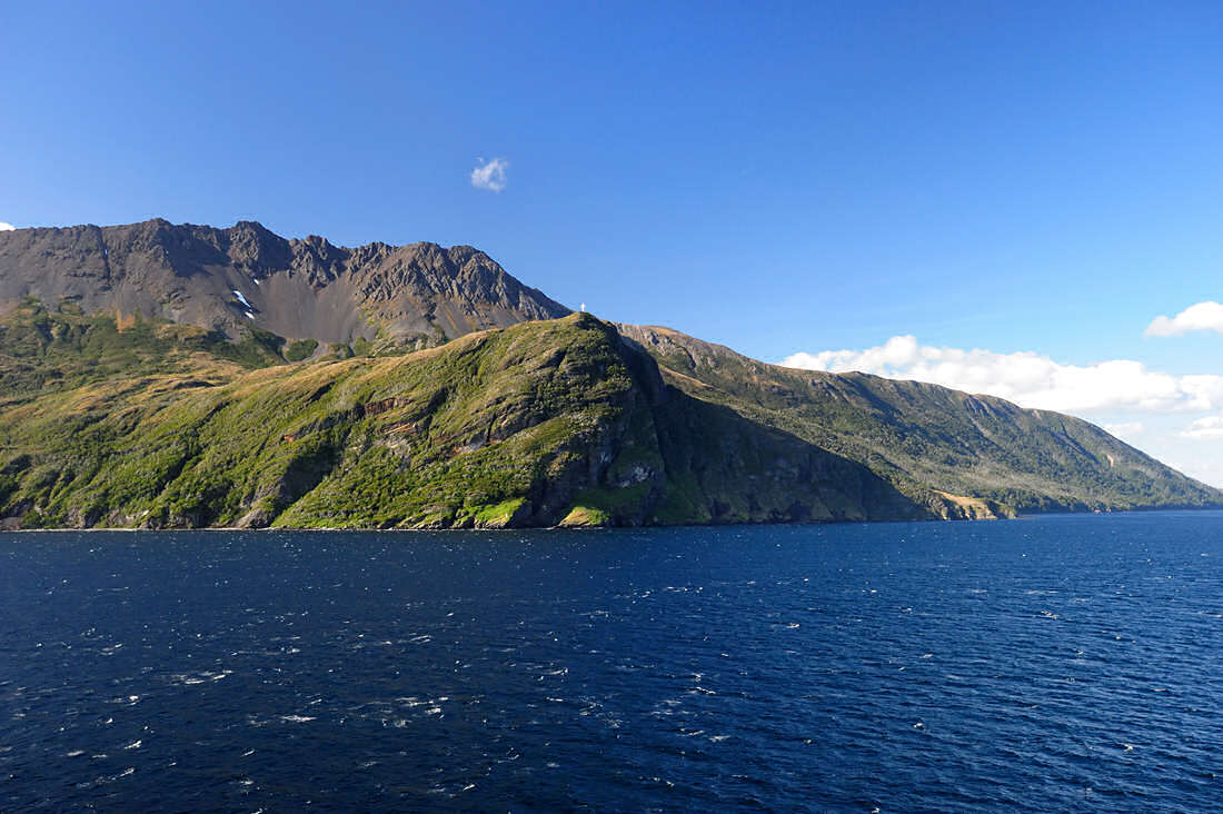
The Beagle Channel, the
Darwin Pass, Timbales Pass, slid by during the night,
unseen in the darkness, our vessel carrying us out into
the Ballerno Channel. The half light of the predawn
carried us across the Ballerno Channel into the Brecknock
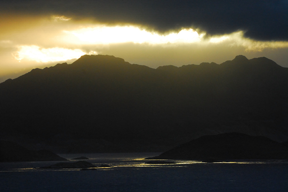
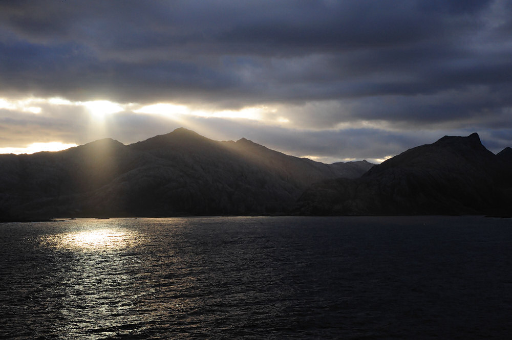
Channel. The first sunrise photo I shot the next
day was the image above as we were transitioning from
the Brecknock Channel into the mouth Cockburn Channel
as the sun rose. The Cockburn Channel opens to the
Pacific Ocean to the west and leads to the Magdalena Channel
and eventually the Strait of Magellen. The light
of the sunrise is seen streaming through the notch between
the mountains in the image above beginning to light the
underside of some of the clouds to the left. The
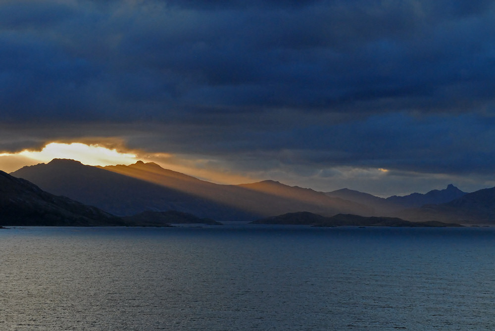
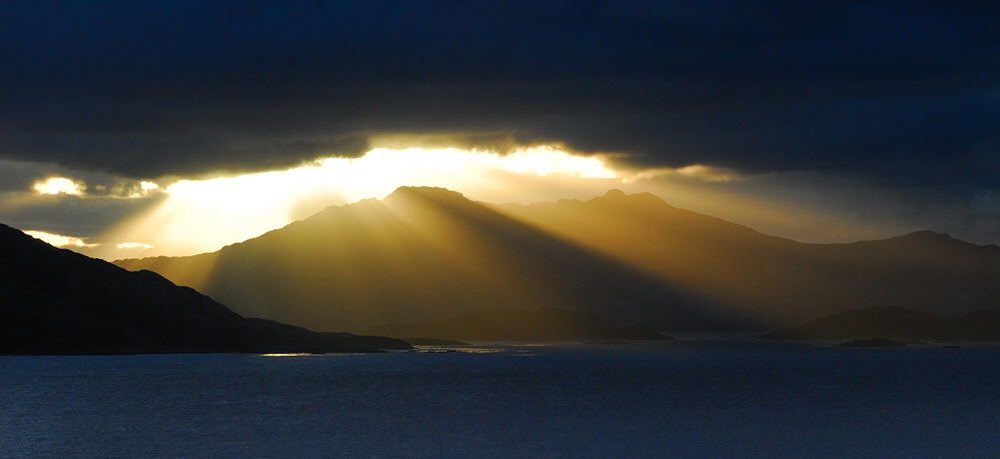
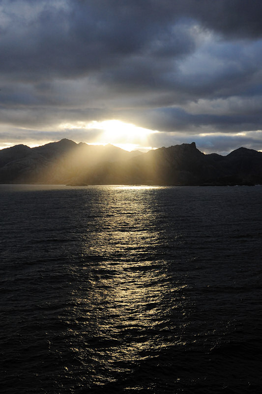
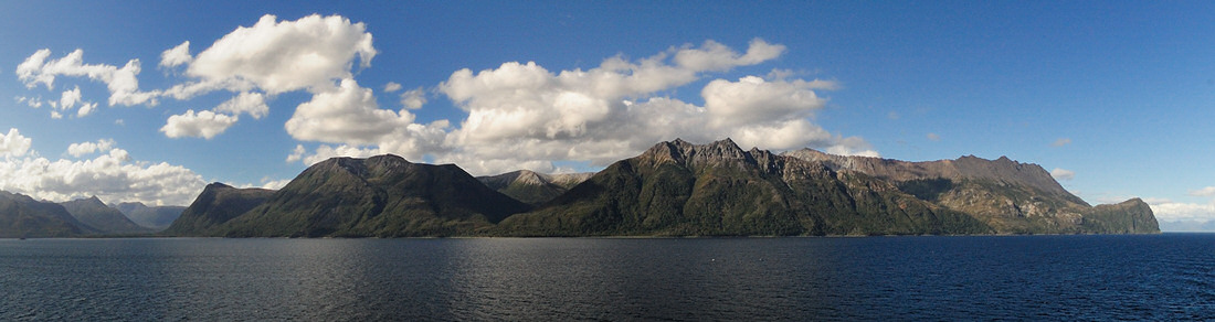
image below shows the sunrise further along that morning.
I was struck by the receeding lines of the moutain ridges
in the image below and the molten feel of the oranges
in the clouds above.
|
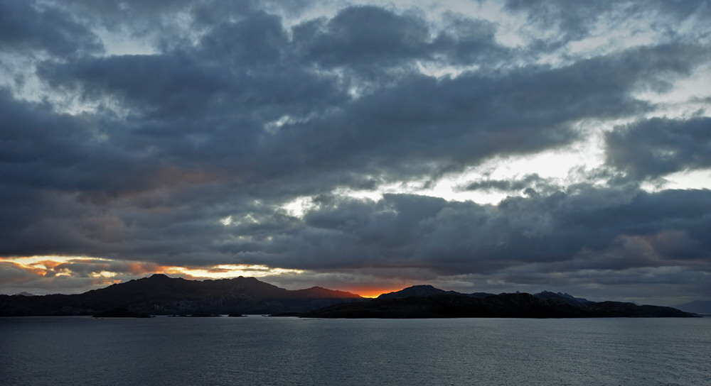
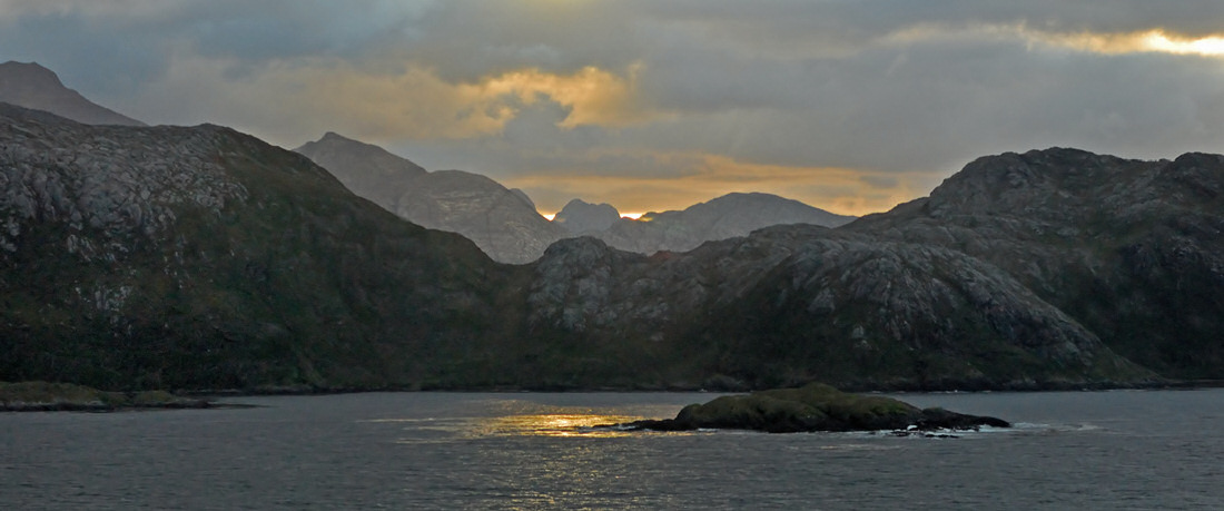
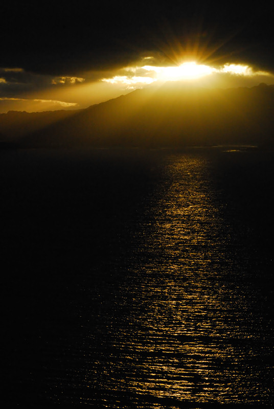
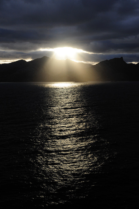
While we were passing
through this section of the channel, we also saw some
spectacular crepuscular rays streaming through a gap in
the clouds creating orange beams of light across the landscape
in the image below. At the time, I didn't know that
what I was seeing in the image below was just a harbinger
of what was coming.
"Dawn Across
the Land"
"Pools of Light"
|
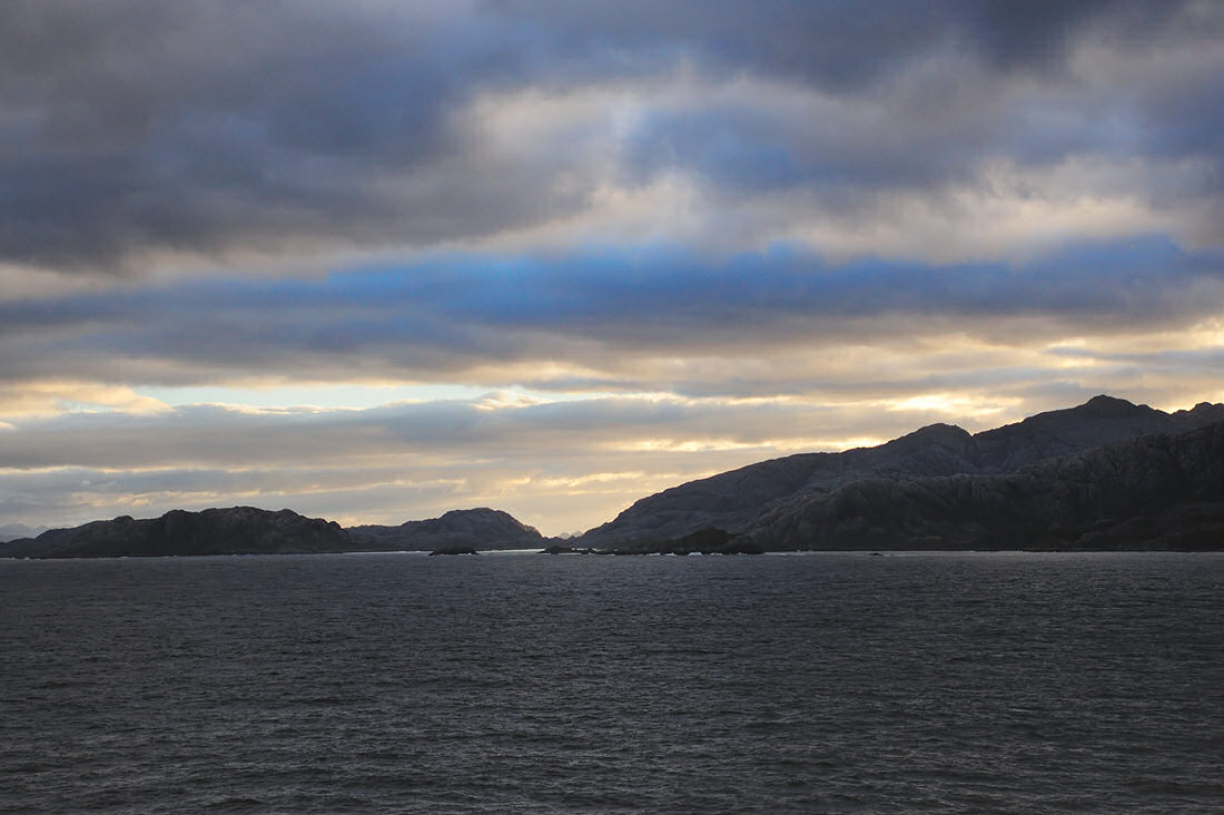
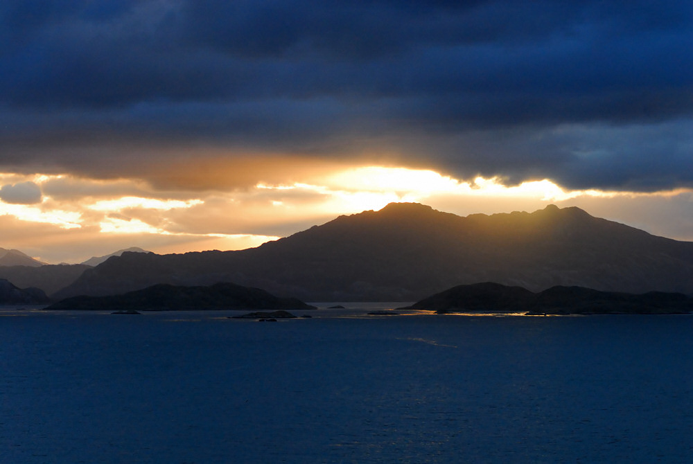
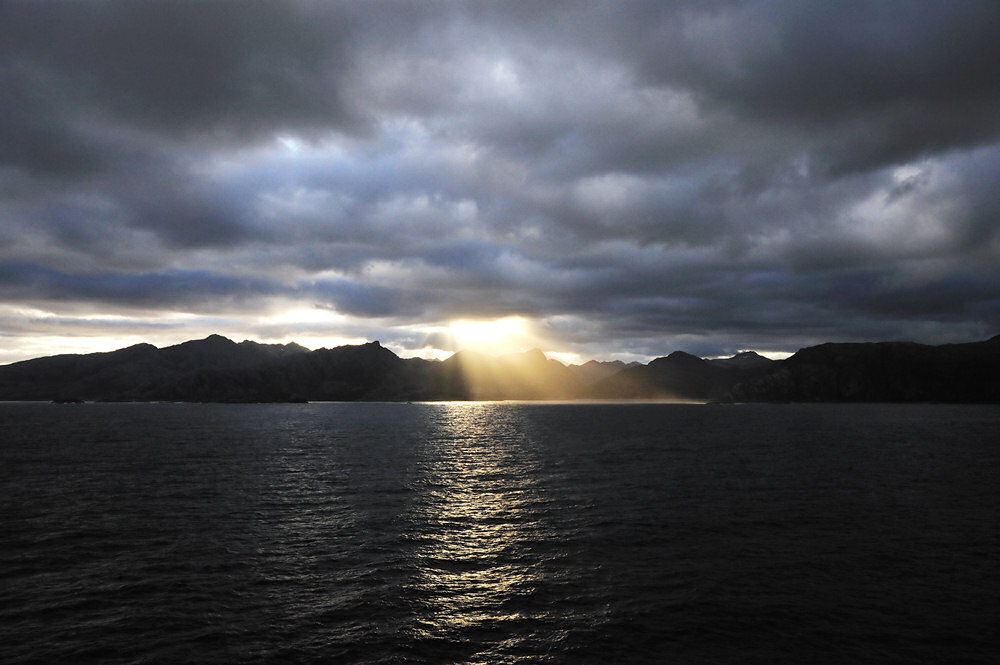
For a time after the firey
oranges of the dawn, the light was more subdued as the
sun undoubted climbed through a layer of clouds giving
the image above. Nevertheless, I like the image
above for the ranges of blue in the sky between the bands
of clouds. A short time later, we began getting
dazzling crepuscular rays streaming through the clouds
"spotlighting" portions of the landscape or
the waters of the channel as seen in the selection of
images below.
|
click image above for a larger
view
|
click image above for a larger
view
|
"Crepuscular
Silhouette"
|
click image above for a larger
view
|
click image above for a larger
view
|
click image above for a larger
view
|
click image above for a larger
view
|
| |
|
All good things eventually
come to an end, and the crepuscular rays that I had the
joy of photographing as we entered the Cockburn Channel
that morning finally died out as the day continued to
brighten.
|
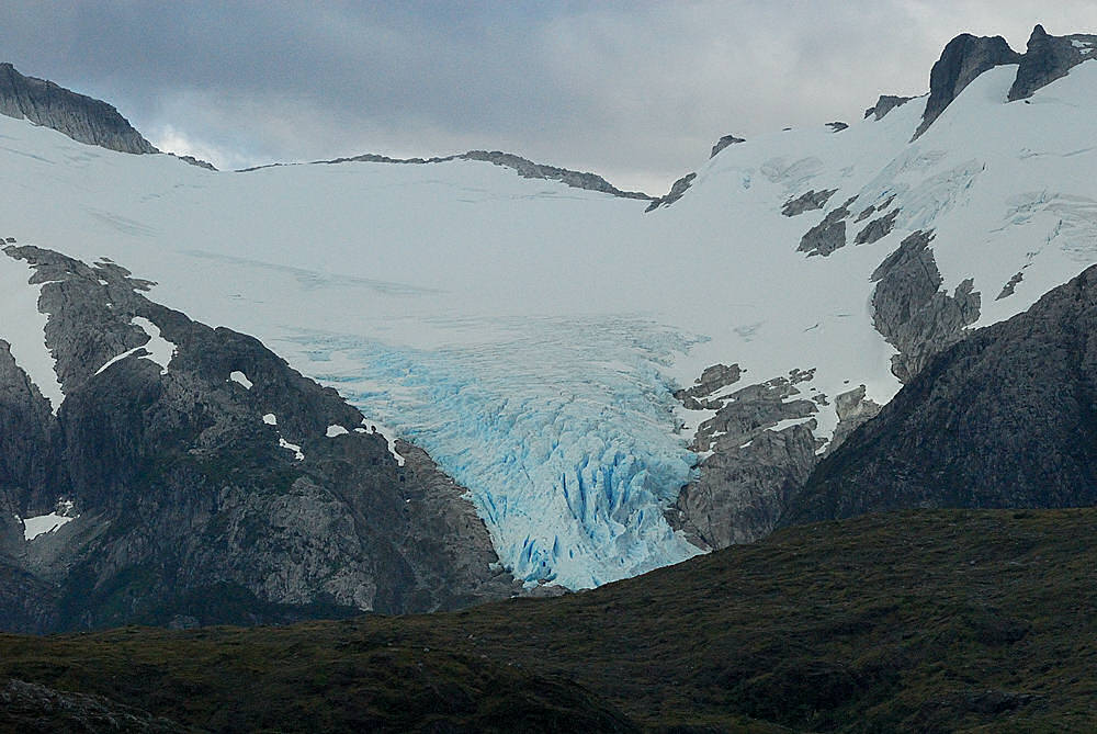
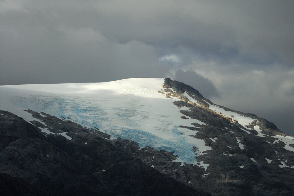
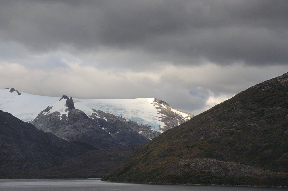
As we navigated through
the Cockburn Channel, after the sunrise the scenery slid
by on both sides of the ship. After breakfast, as
we saw some small hanging glaciers off to the starboard
side of the ship from the balcony of our stateroom.
There are several photos from these small glaciers below.
You'll note that the ice has a pronounced blue color to
it near the bottom of the glacier in several of the photos.
This is old ice... ice that has probably been there for
100 years or more in some cases, working its way down
the glacier as it flows down the side of the mountain
that it calls home.
|
click image above for a larger
view
|
click image above for a larger
view
|
click image above for a larger
view
|
click image above for a larger
view
|
|
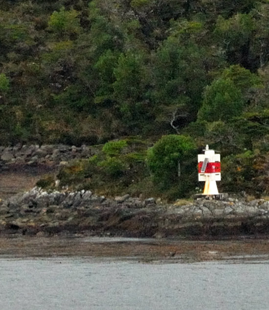
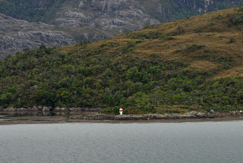
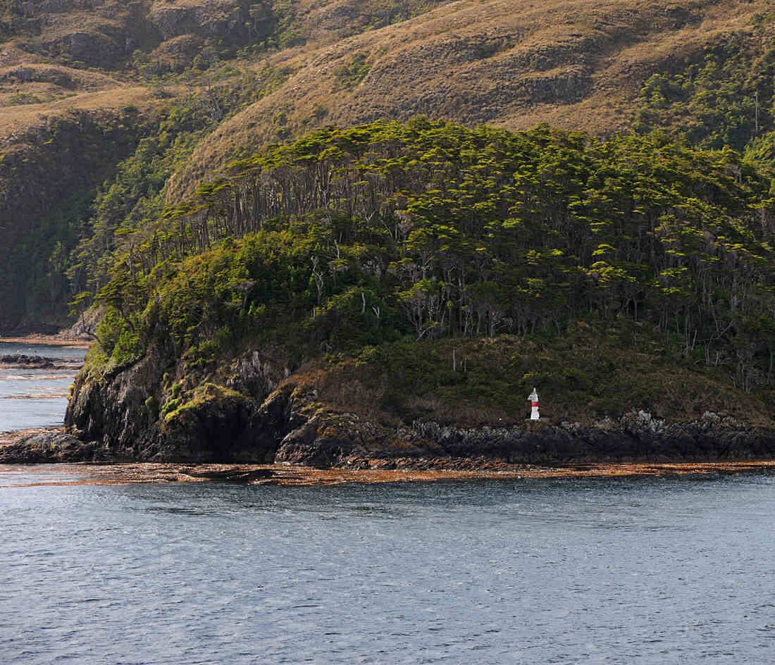
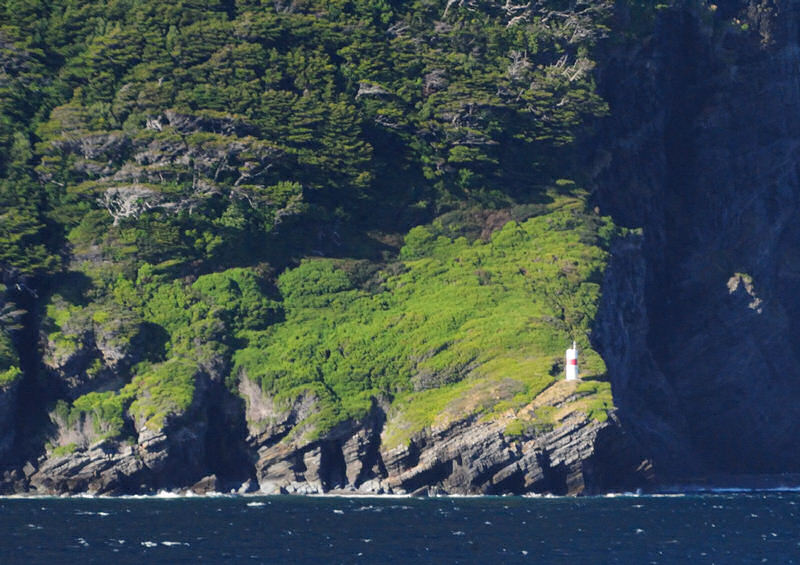
The Brecknock Channel
has some twists and turns to it. Later into the
morning, the ship turned to starboard and then we rounded
King Island off the starboard side as we began to approach
the entrance to the Magdalena Channel. King Island
has a small channel light on the southeast tip of the
island. The channel light is shown in the two photos
above.
|

|
|
click image above for a larger
view
|
click image above for a larger
view
As you leave the Magdalena
Channel to enter the Strait of Magellan, there is another
small channel light on the east side of the Magdalena
Channel that is shown in the photo above and to the left.
|
|
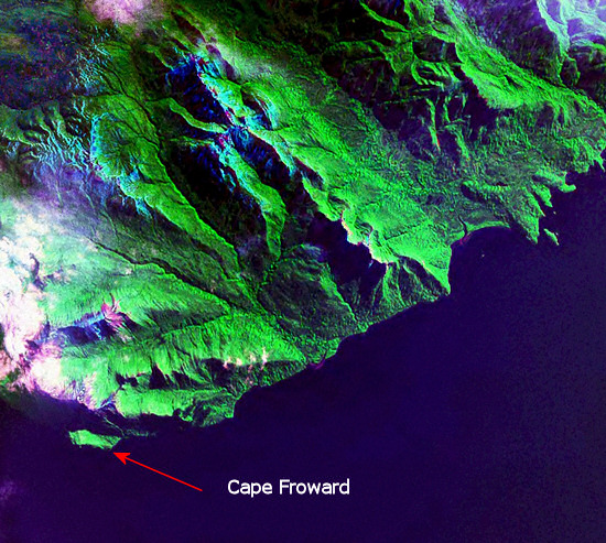
Where the
Magdalena Channel opens into the Strait of Magellan is an
extremely wide area of the Strait. Slightly west of
north is Cape Froward which is the subject of the following
section of this page. Cape Froward has the distinction
of being the southernmost point of land of the South American
continent proper. The entire archipelago that contains
Isla Grande Tierra del Fuego is not actually a part of the
continent, being separated from the continent by the Strait
of Magellan.
|
|
|
|
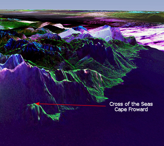
The two images above were
generated using NASA's World Wind 1.4 software with Geocover
2000. The view on the left looks straight down on
Cape Froward. The view on the right is tipped to
an angle to give you a better feel for the topography
of the area. The Cross of the Seas stands atop the
small peak indicated by the red arrow in the image above
on the right. Punta Arenas would be somewhere off
the top of the page to the left in the image on the right.
|
click image above for a larger
view
|
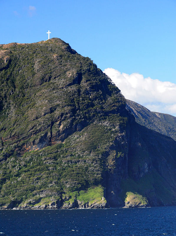
The first good image that
I managed to shoot of the Cross of the Seas was after
we had passed Cape Froward and were sailing north toward
Punta Arenas. The image to the left was shot off
the stern of the Splendor as we sailed northeast in the
Del Hambre Pass and you can see the white Cross of the
Seas atop the peak.
Earlier images shot when
were coming out of the mouth of the Magdalena Channel
were quite hazy and the light made it difficult to see
the cross at all.
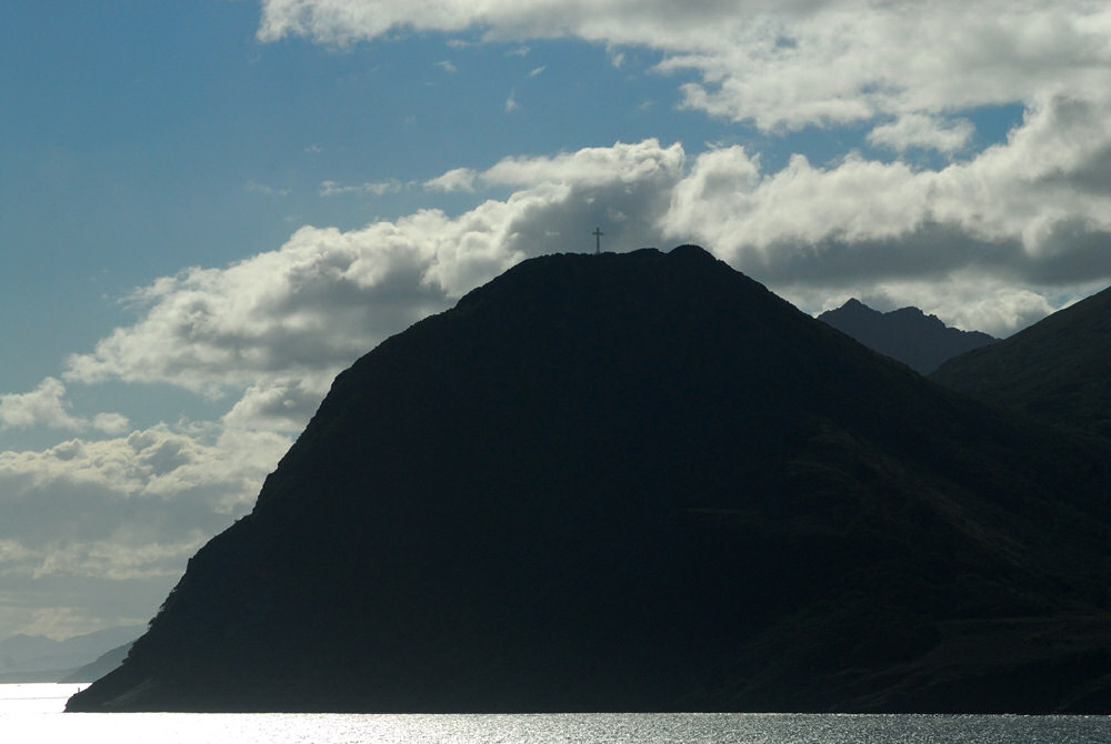
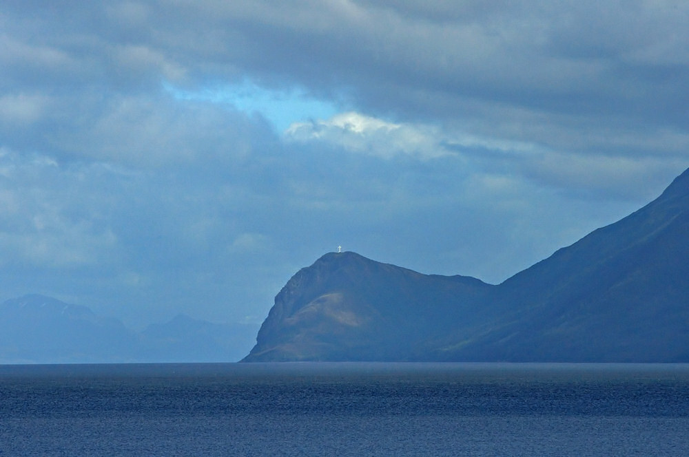
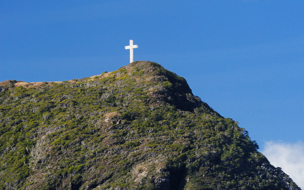
In the late afternoon,
after departing Punta Arenas after the ship had cleared
Chilean immigration, the Cross of the Seas was dramatically
silhouetted atop Cape Froward as seen in the image below.
Although it is somewhat harder to pick out, the Cape Froward
channel light is also visible at the bottom of the image.
|
|
|
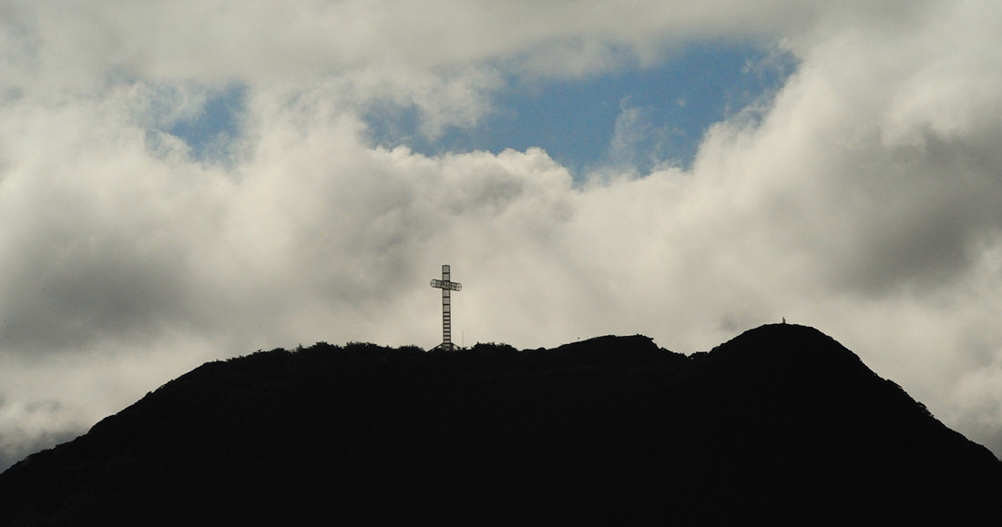
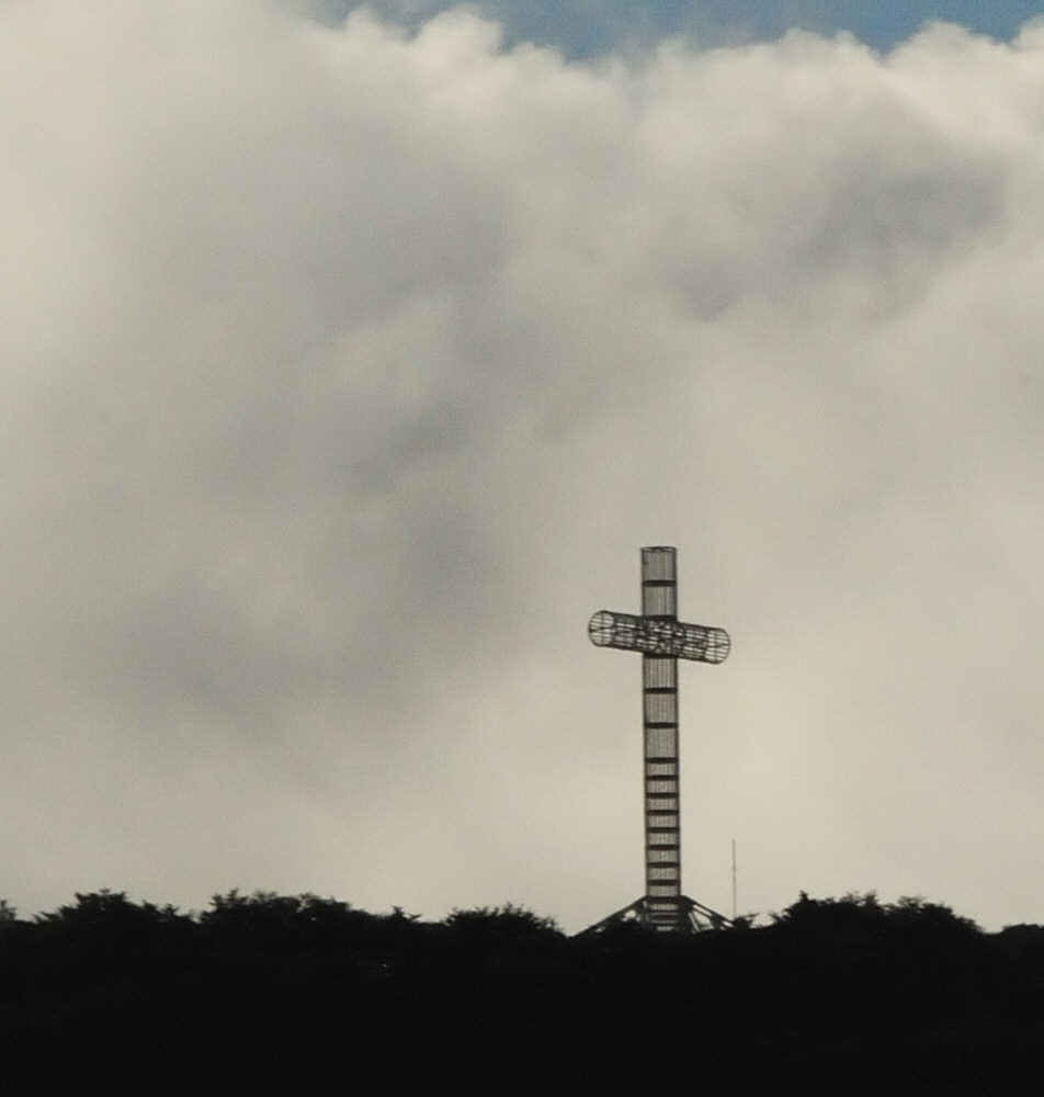
The image above was taken
from the same location as the previous image albeit with
a 'slight' change in focal length going from a wide angle
to long telephoto at 600 mm. In this image you can
begin to see the open tubular steel construction of the
Cross of the Seas. This is the third cross constructed
atop this mountain. The first cross was built
in 1913 of cast iron, stood about 30 feet high, and collapsed
in the strong winds that sweep these peaks in 1930.
The second cross was built in 1944 of reinforced concrete
and stood about 65 feet tall. That cross succumbed
to earth tremors and the harsh weather in 1956.
The third and present Cross of the Seas is constructed
of a lattice of tubular steel to allow the winds to flow
through it rather than pushing against it. The cross
was constructed in 1987 to commemorate the visit of Pope
John Paul II to Chile. It stands about 79 feet tall
and the arms are 33 feet across. The cross is oriented
due north-south.
|
click image above for a larger
view
|
click image above for a larger
view
|
click image above for a larger
view
|
click image above for a larger
view
|
click image above for a larger
view
|
click image above for a larger
view
|
|
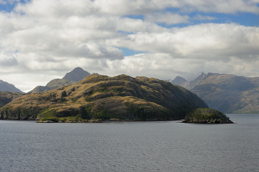
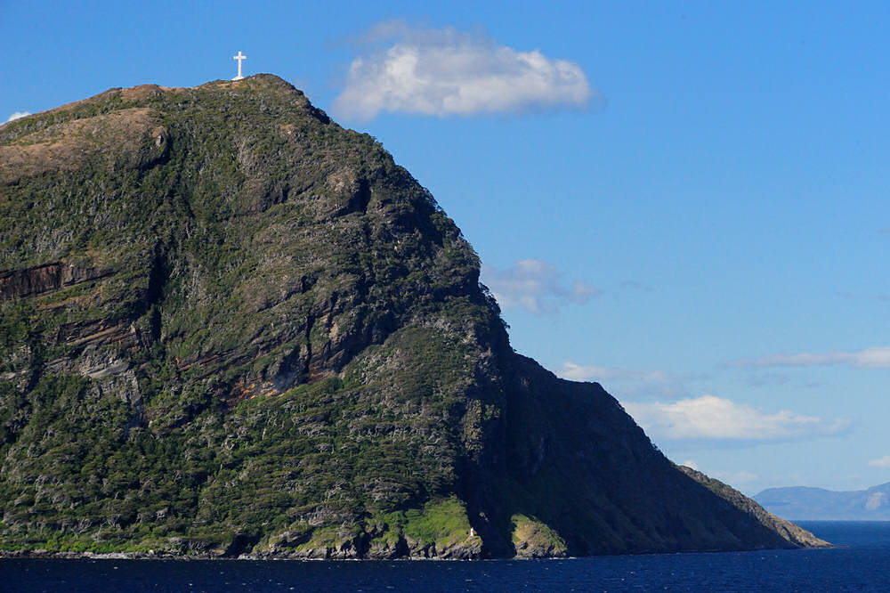
Ultrawide angle view of
Cape Froward (on the right) the southernmost point of
the continent of South America. This photograph
was shot after we had rounded Cape Froward and were sailing
westward in the Strait of Magellan.
Normally, cruise ships
sailing the Strait of Magellan that stop in Punta Arenas
sail late enough from Punta Arenas that passengers only
get to see the Cross of the Seas at twilight. Since
our 'shore leave' in Punta Arenas had to be canceled because
of the very late departure out of Ushuaia the night before,
while we didn't get to Magdalena Island to see the lighthouse
and the magellanic penguin colony there, we did get to
see the Cross of the Seas in the beautiful light of the
late afternoon. I guess life does have it's tradeoffs...
|
|
|