
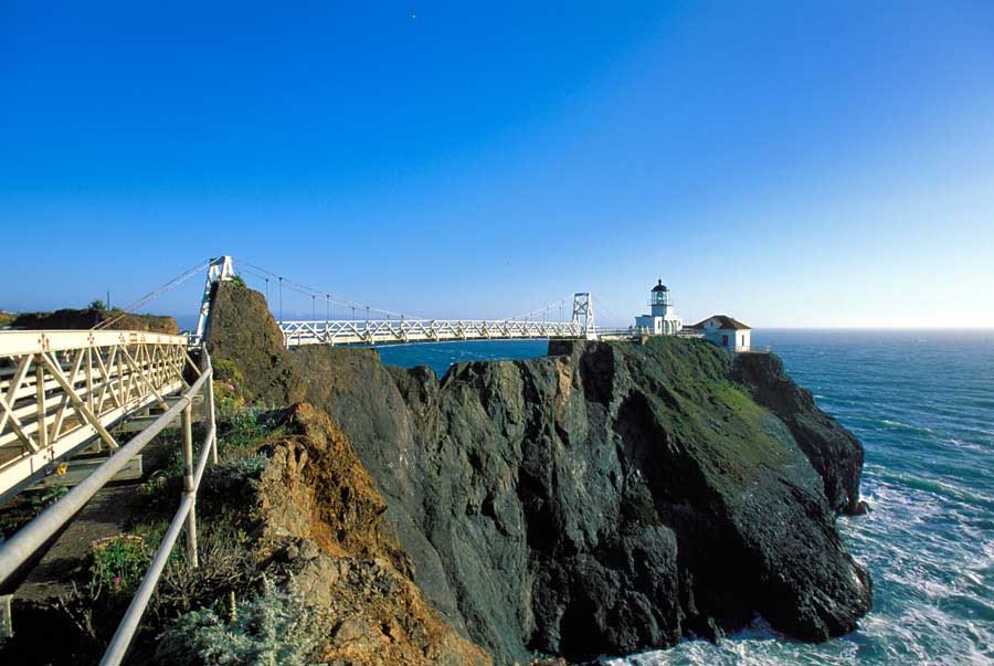
Point Bonita lighthouse stands atop a rocky pinnacle at the mouth of San Francisco Bay. Just getting down to the lighthouse is a unique experience... the path winds along the back side of the rocky cliffs and eventually brings you to a gated tunnel in the rock that is locked when the lighthouse isn't open for visitors. When it is open, you walk through a rough hewn rock tunnel for 50 feet or so and then back out into the open again. The trail continues downward and eventually gives you a few teasing views of the lighthouse before opening up at the beginning of the elevated walkway that leads to where the suspension bridge begins. Yes, you read that correctly... you reach Point Bonita lighthouse by crossing a suspenion bridge... the cliffs fall away too steeply on either side of the span that the bridge crosses for there to be a trail out to the lighthouse. I've been fortunate enough to be down at Point Bonita for several sunset shoots over the years. Some of my collection of images of Point Bonita are shown below. Click any of the images for a larger view! The map immediately below shows the Golden Gate area. The red line leaving Hwy 101 on the north side of the bridge is the route out to Point Bonita. There is parking where the green lines depart the red route. By following the road out to where it ends at a parking lot, you can also get distant shots of the lighthouse. The shorter green line is the trail that leads up to where a World War II radar station was located that is a great spot to shoot down onto Point Bonita from. The longer green line leads out to the lighthouse itself. From Point Bonita you can see both towers of the Golden Gate bridge as well as the Fort Point light beneath the south end of the span and the remains of the Mile Rocks lighthouse off the Richmond District of San Francisco. |
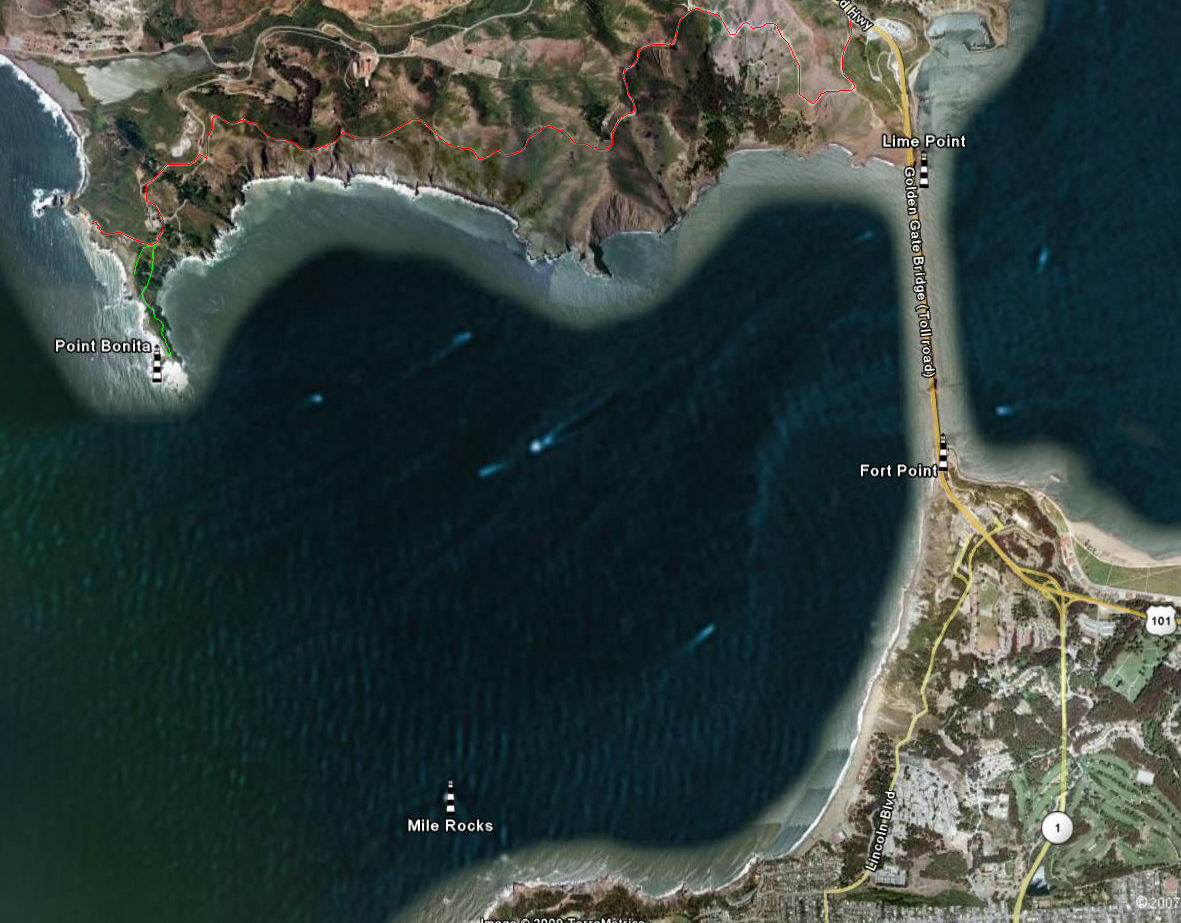
map Copyright Google 2007
 |
 |
After you cross the Golden Gate Bridge on Hwy 101, the exit ramp takes you down and then under Hwy 101 before climbing up into the Marin Headlands. After you see the tremendous views of the north tower of the bridge with the city behind it in the distance, you continue to climb higher. Once you crest the Headlands, you see the rocky promontory jutting out into the Pacific in front of you. This is the home of Point Bonita.
|
|
|
 |
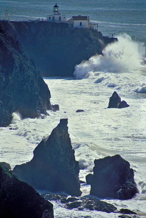 |
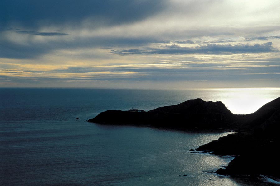
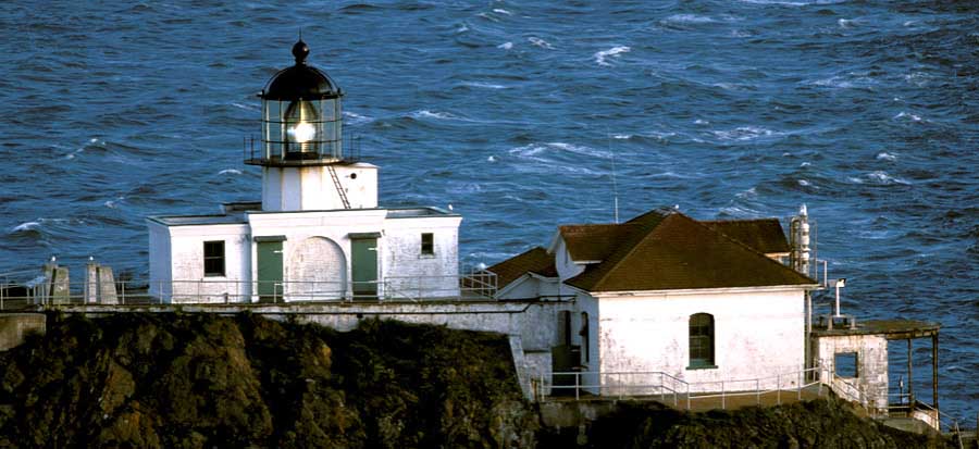
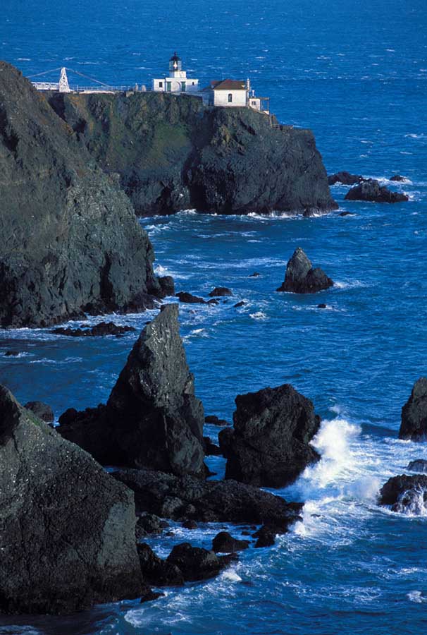
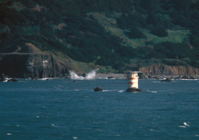
The top two photographs immediately above were shot from up near where a World War II radar station was located. The bottom two shots above were taken from the parking lot at the Bird Island Overlook at the end of the road.
|
 |
 |
 |
|
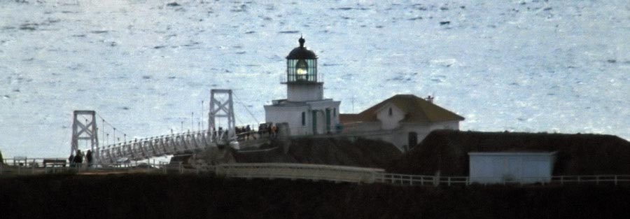
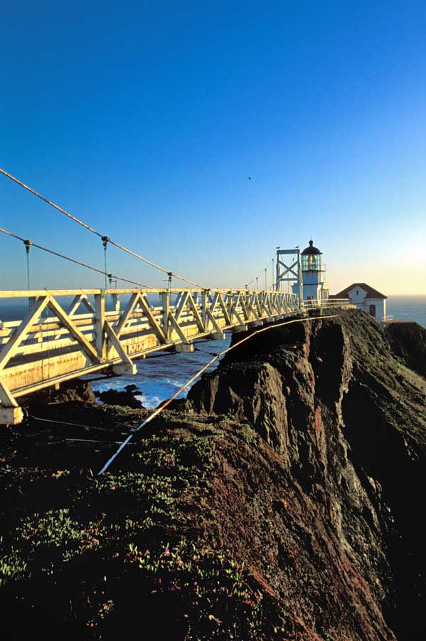
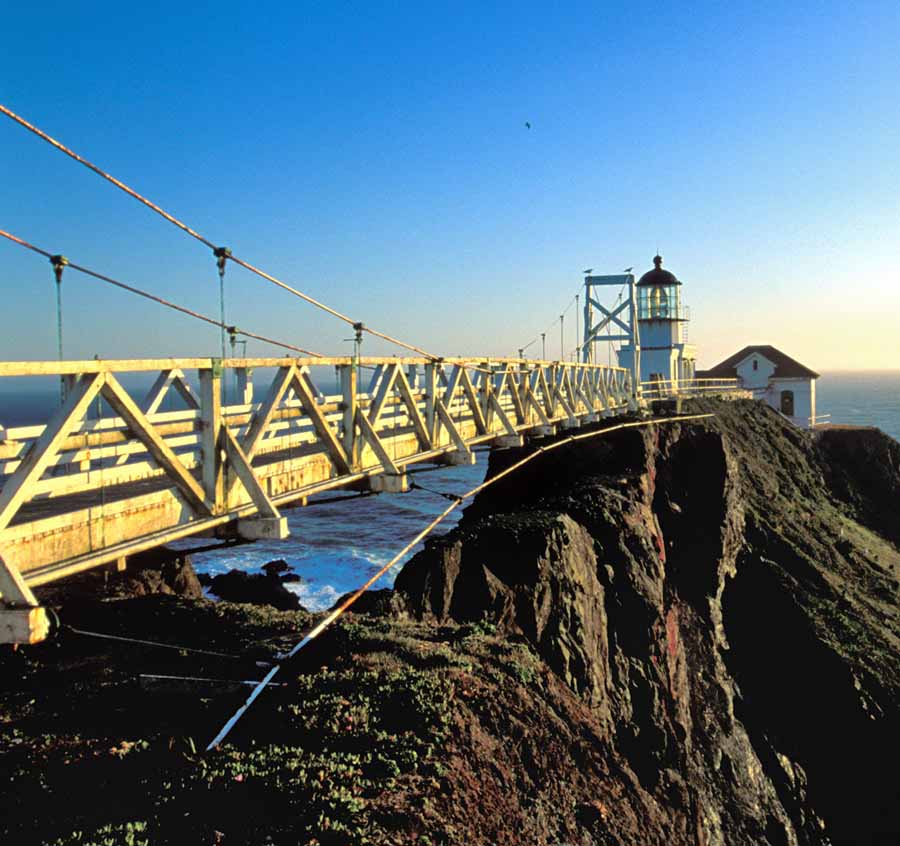
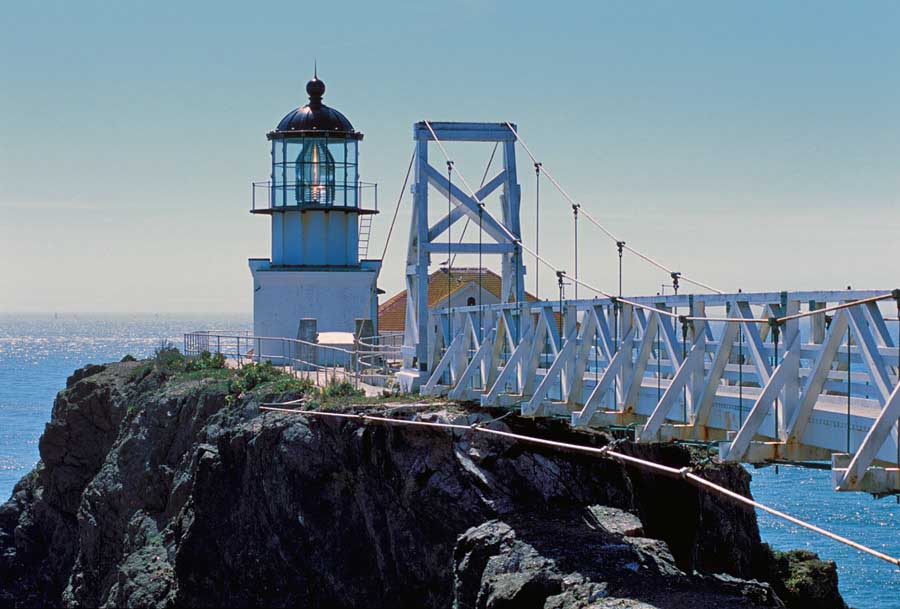
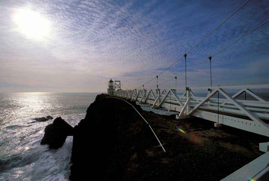
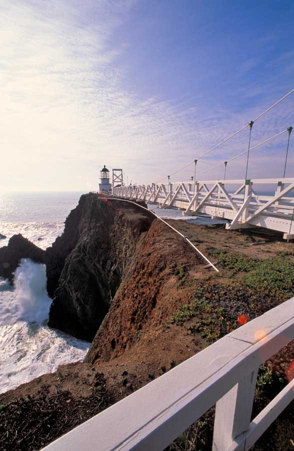
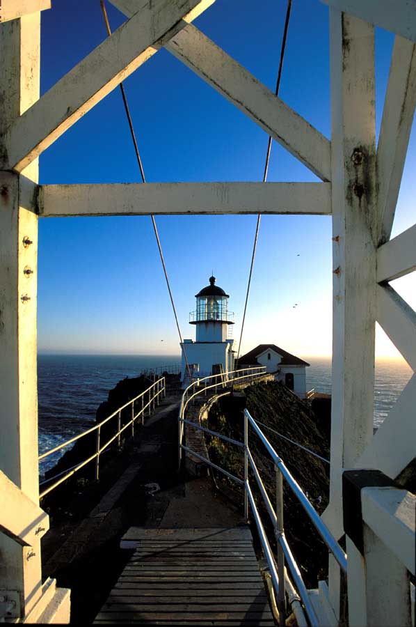
These photos
were shot in the late afternoon during a pre-arranged sunset photo
shoot at Point Bonita in 2002. The upper left shot was taken
when the trail first opens out and you begin to get good views
of the lighthouse. The elevated walkway is on the left.
The "land" side tower of the suspension bridge is seen
just standing above the rock pillar. The other two photographs
show the view across the suspension bridge to the lighthouse itself. |
|
|
|
|
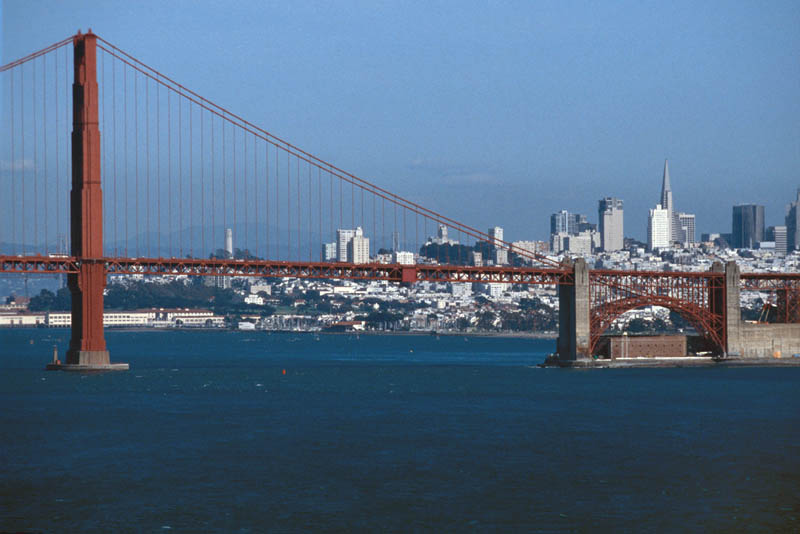
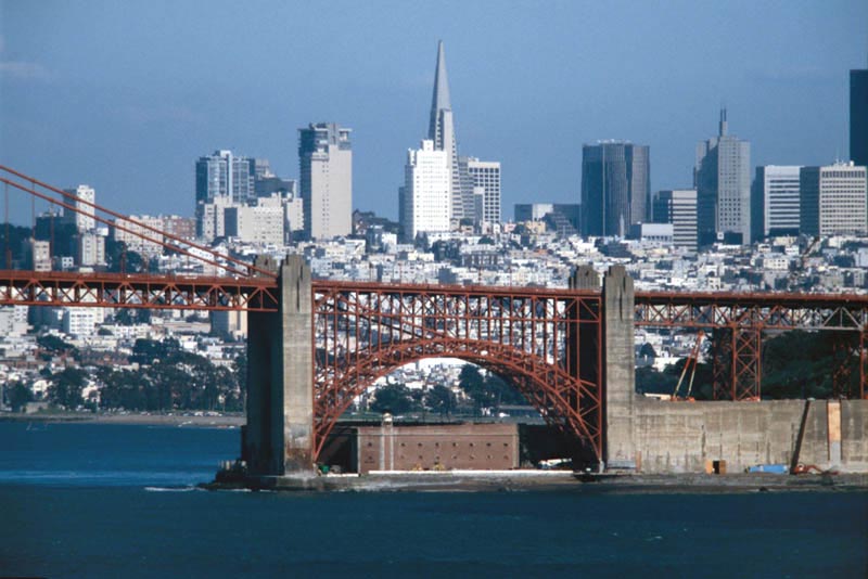
The two
photos above shot looking toward San Francisco show the location
of the Fort Point lighthouse beneath the span of the bridge atop
the fort. The photograph to the light shows all that is
left of the Mile Rocks lighthouse that marks some trecherous rocks
off the south side of the entrance to the Bay. |
|
|
|
|
The tunnel
leading to Point Bonita is open on the weekends for visitors to
the lighthouse from 12:30 - 3:30 PM. Not at all a great
time for photography but certainly better than not getting to
visit the lighthouse at all... |
|
|
|
|
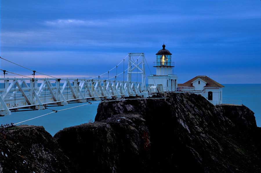
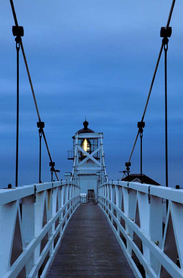
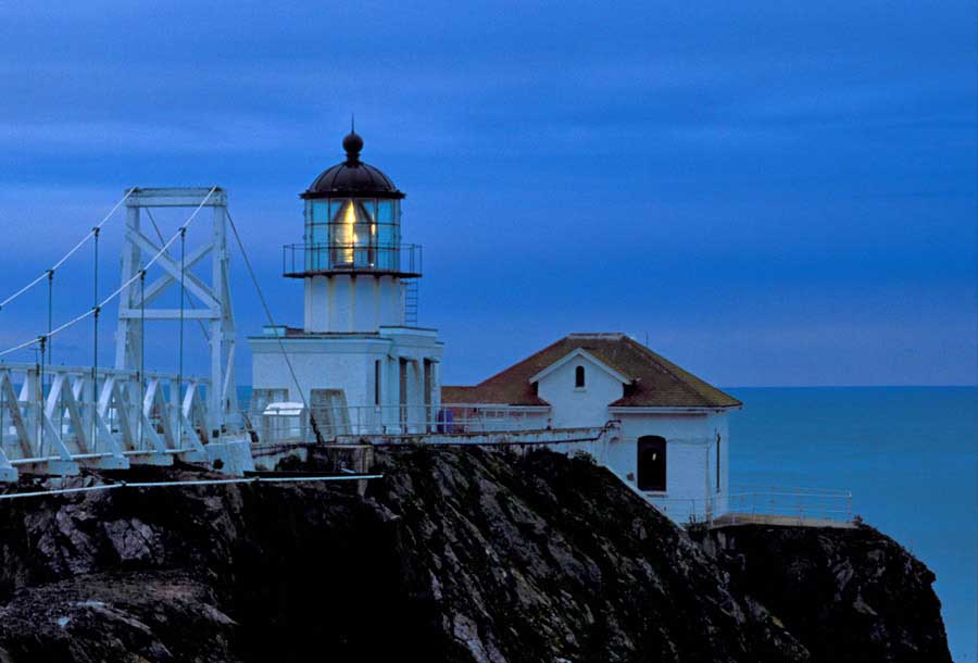
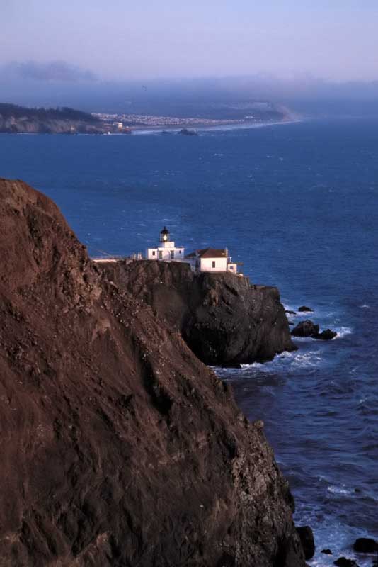
Several views across the bridge are shown on the left above. Both were taken during sunset shoots at Point Bonita. The photos on the right show two views of the suspension bridge and the lighthouse in the evening before sunset.
|
 |
 |
|
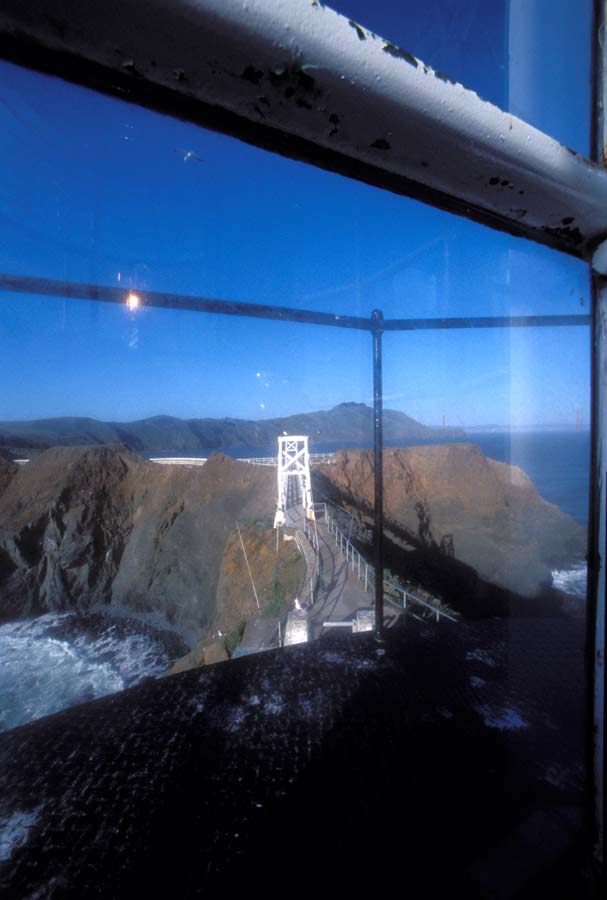
Views looking back across the suspension bridge from inside the lantern room of Point Bonita.
|
|
|
|
 |
|
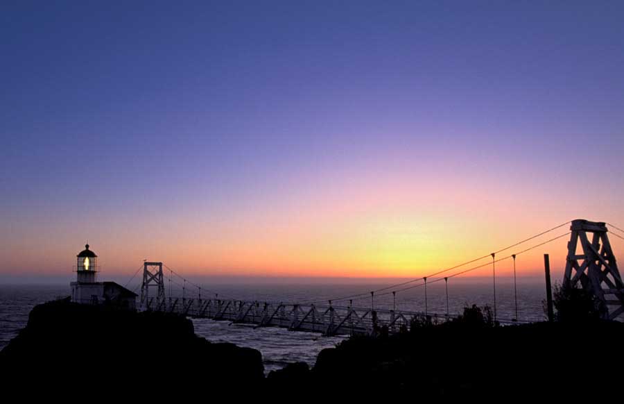
Sunset
is a truly special time at Point Bonita. I feel privledged
to have been able to photograph the sunset from there on several
occasions... |
|
|
|
|
|
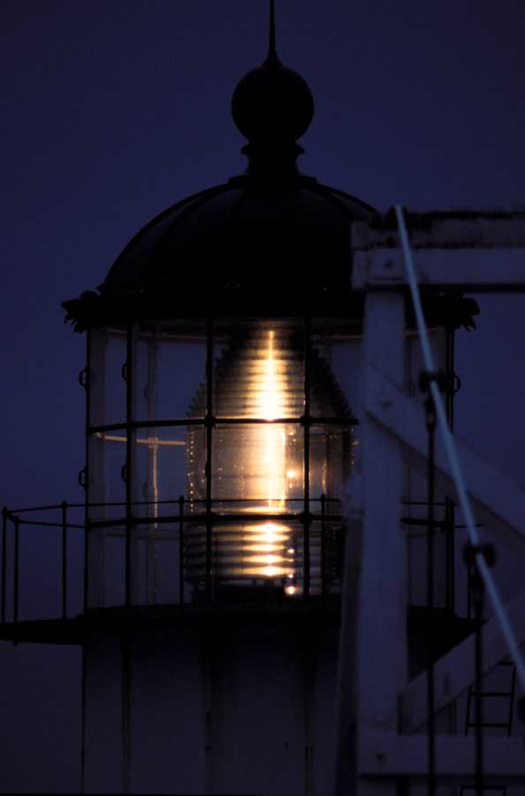
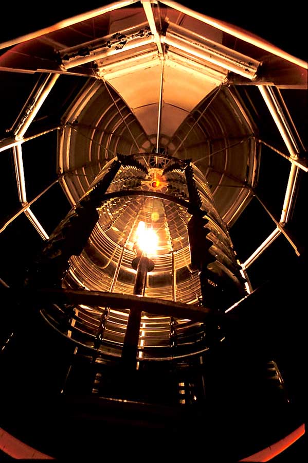
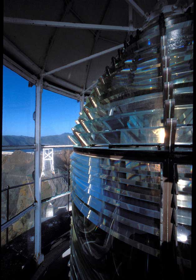
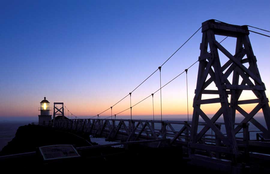
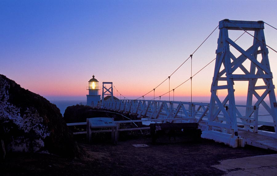
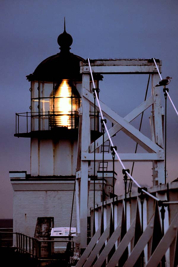
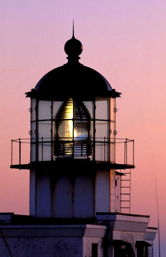
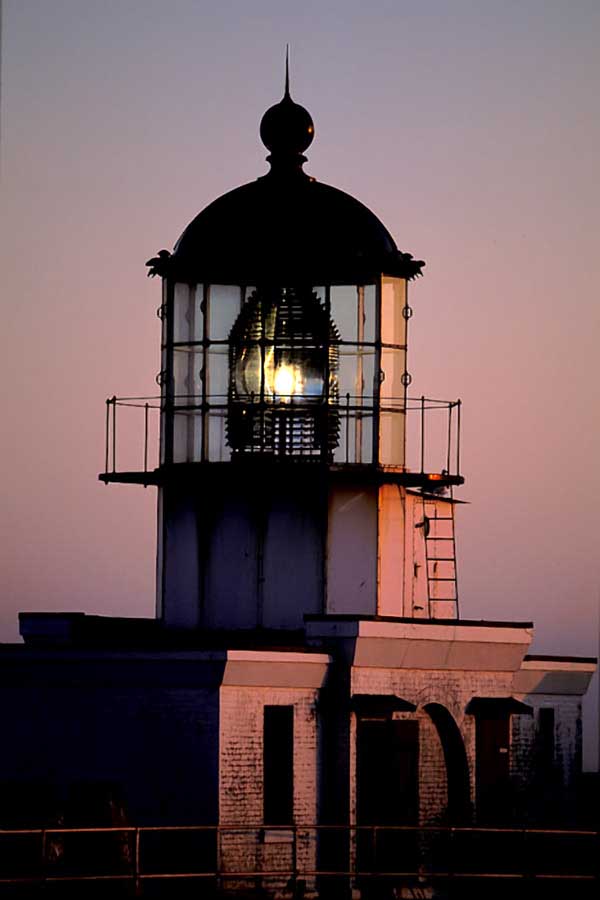
Several photographs of Point Bonita in the evening with the Fresnel lens lighted. The photograph immediately to the left was shot at night looking up into the Fresnel lens from below. |
To view a slide/audio of these images CLICK HERE
Click Here to go back to the California lighthouse page