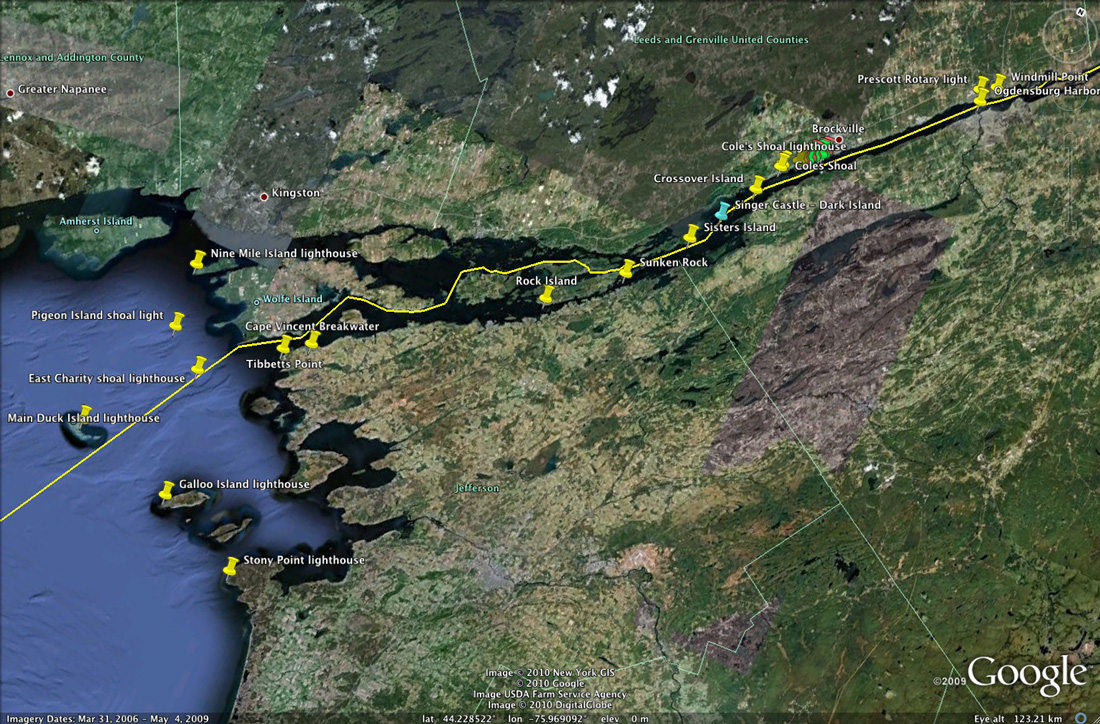
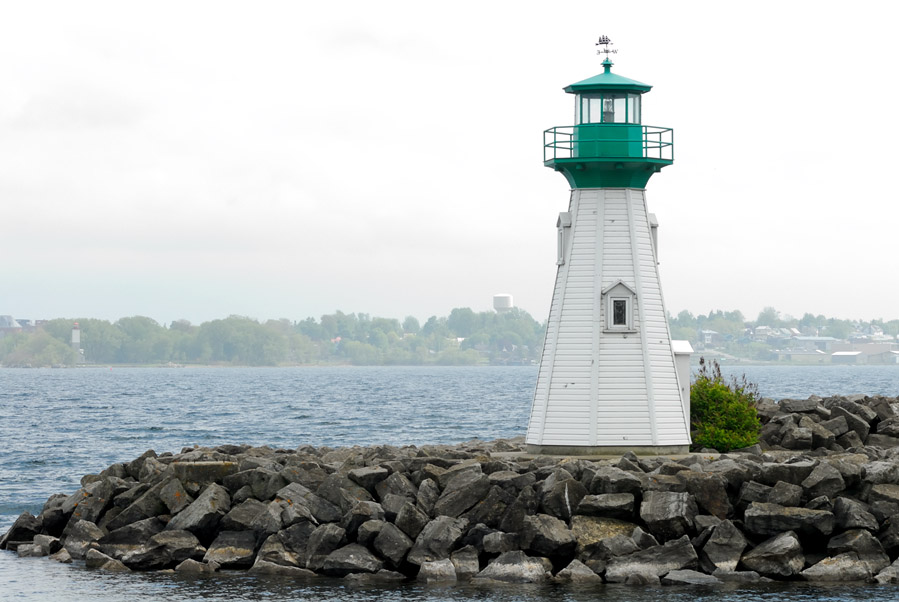
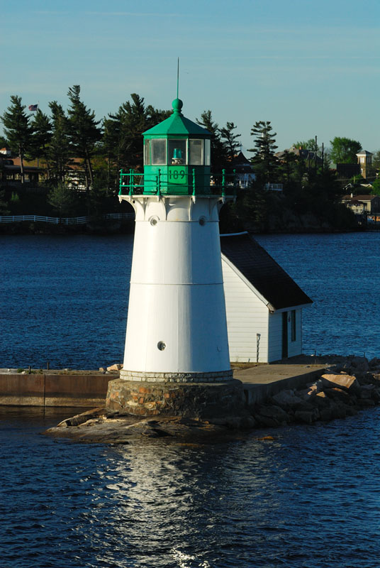
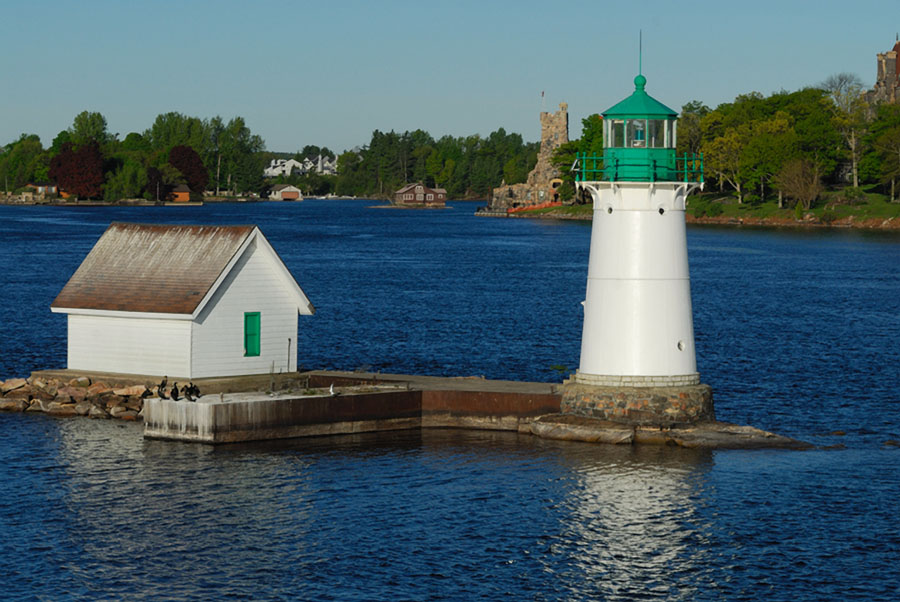
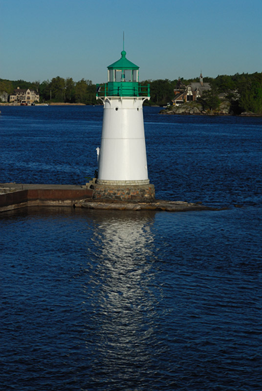
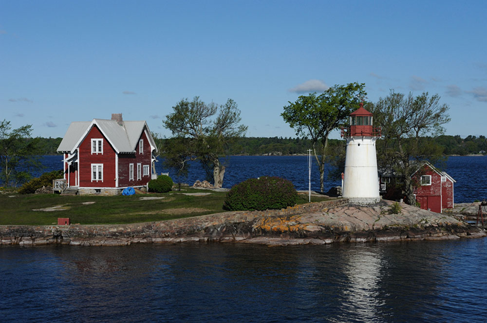
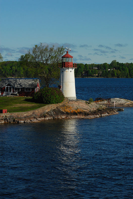
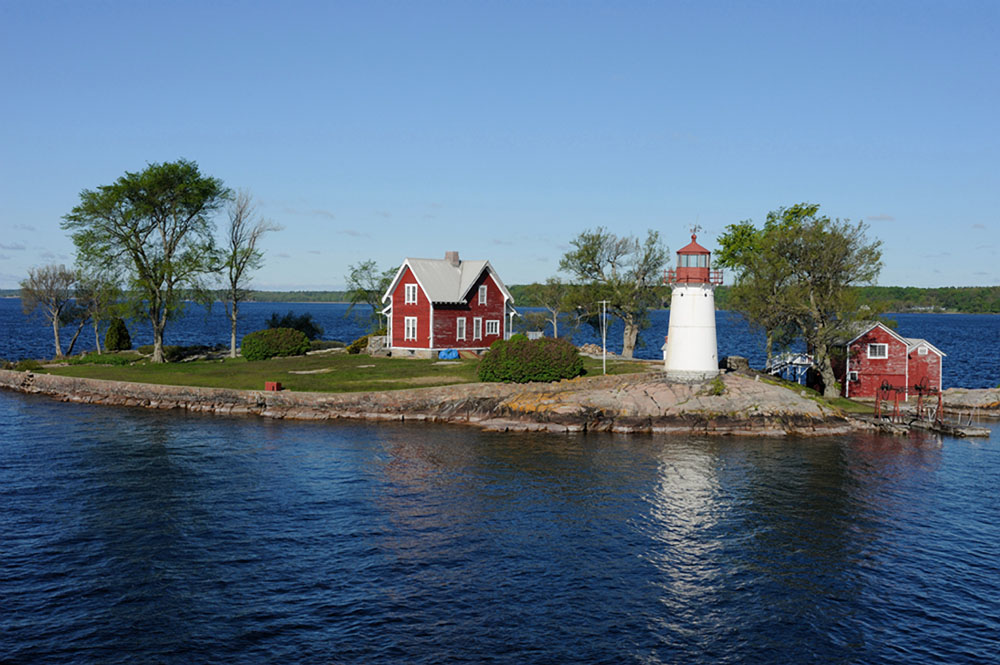
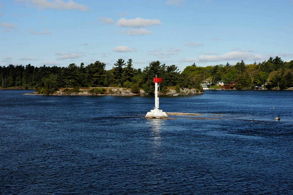
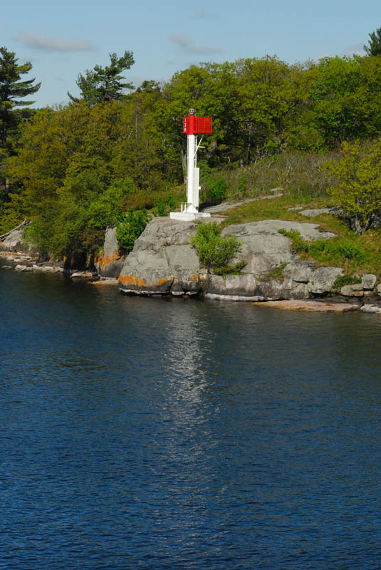
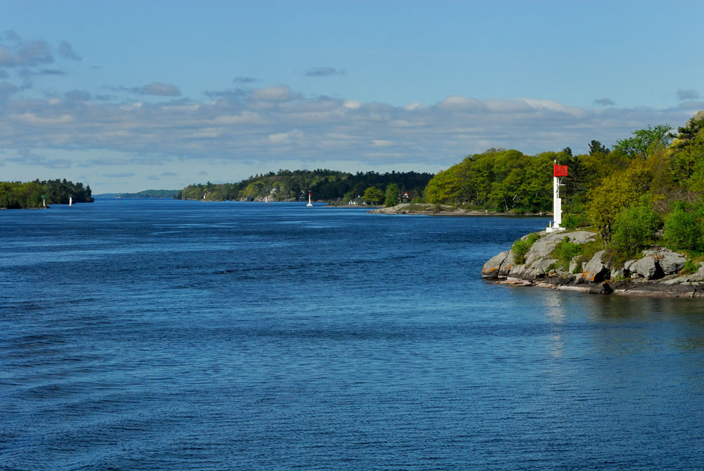
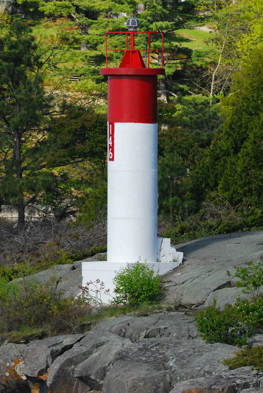
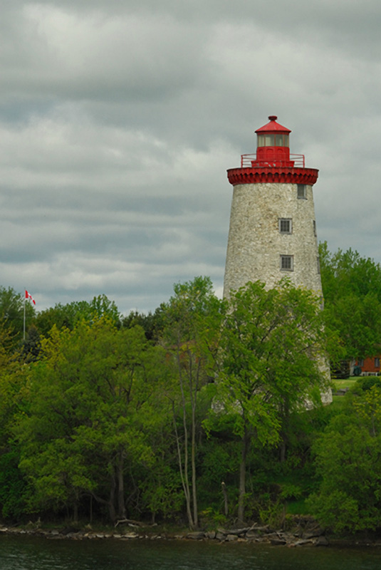
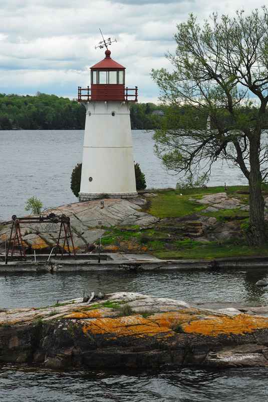
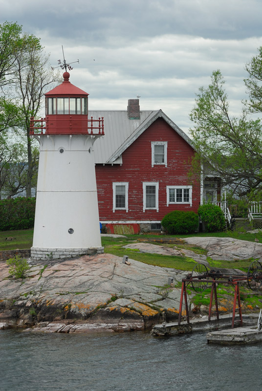
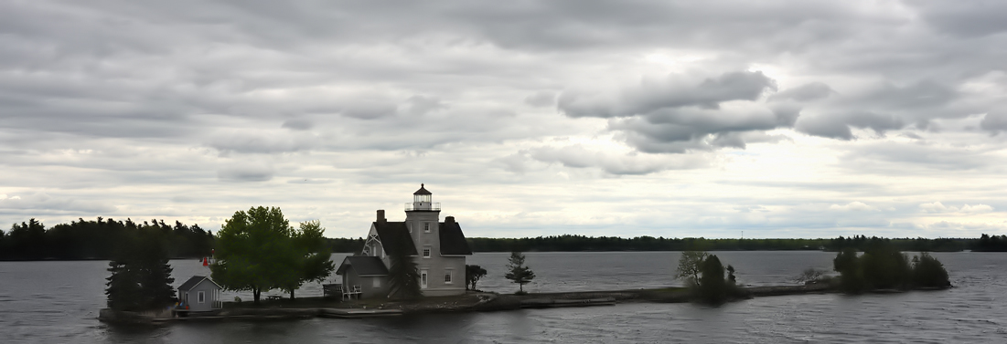
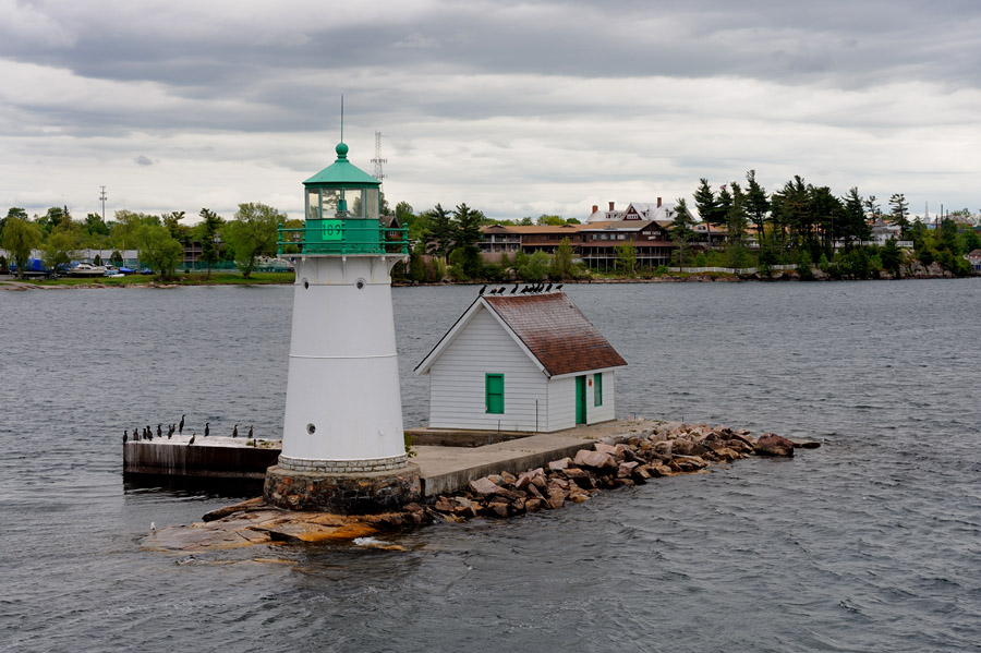
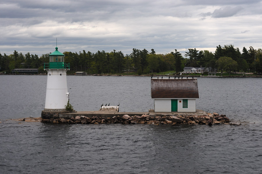
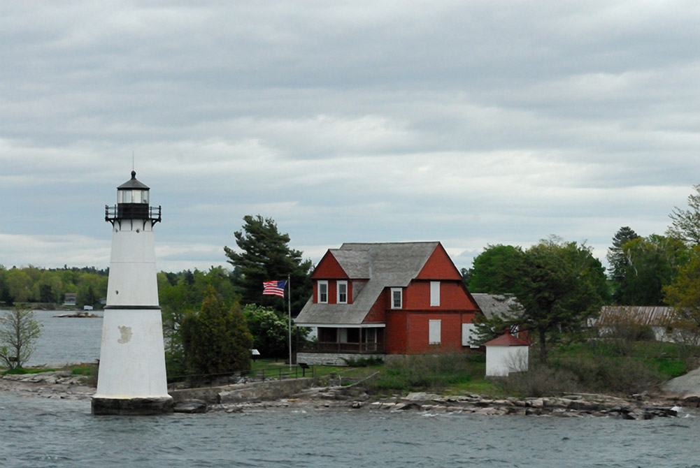
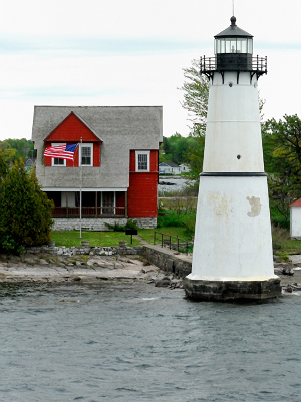
This page is a photo chronicle of a day spent on the St Lawrence River in mid-May with a group from NELL on an Uncle Sam's Charter. The trip began and ended in Alexandria Bay. The morning dawn clear despite heavy overcast the evening before. We made our way out onto the river and from the marina you immediately have the Sunken Rock lighthouse in front of you. Sunken Rock has been decommissioned as a lighthouse but is still well maintained and used as an aid to navigation, marking the channel for salties and Great Lakers alike in the Thousand Islands Section of the St Lawrence River. Some regions of the map below are congested -- there are expansions of various regions further down on this page. |
Map Copyright Google
2008 |
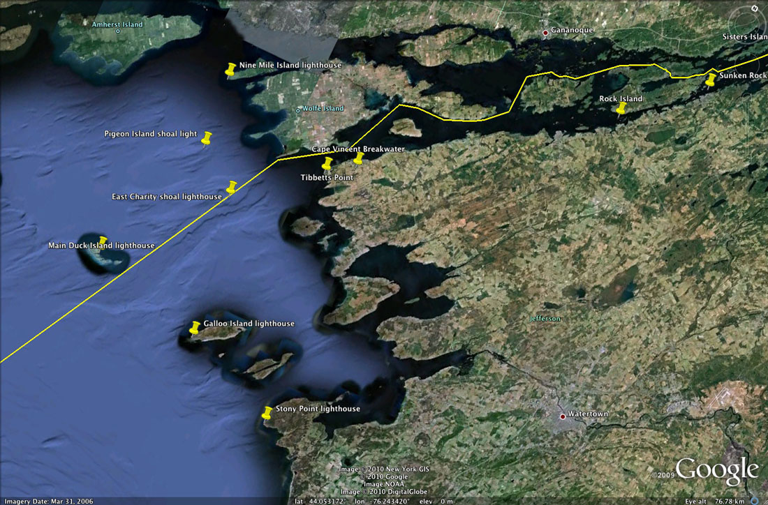
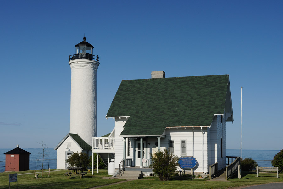
The map above shows the the segment of the St Lawrence River that we covered on the trip. On the way up to Alexandria Bay, I stopped at Selkirk, Stony Point, and Tibbetts Point to visit the lighthouses in those three locations. As noted above, the day was heavily overcast so no grey skies photos of those lights on this page. While I'm a really big fan of threatening weather images with dramatic cloud structure, flat, grey cloud bottoms don't do a thing for me! I had a spectacular room at the inn as it were... on a corner with a window looking down river at Sunken Rock and a balcony looking directly across at Boldt Castle on Heart Island out in the middle of the river. The shipping channel ran between my room and Heart Island... how could it have been better? |
|
|
|
|
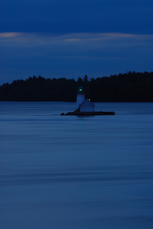
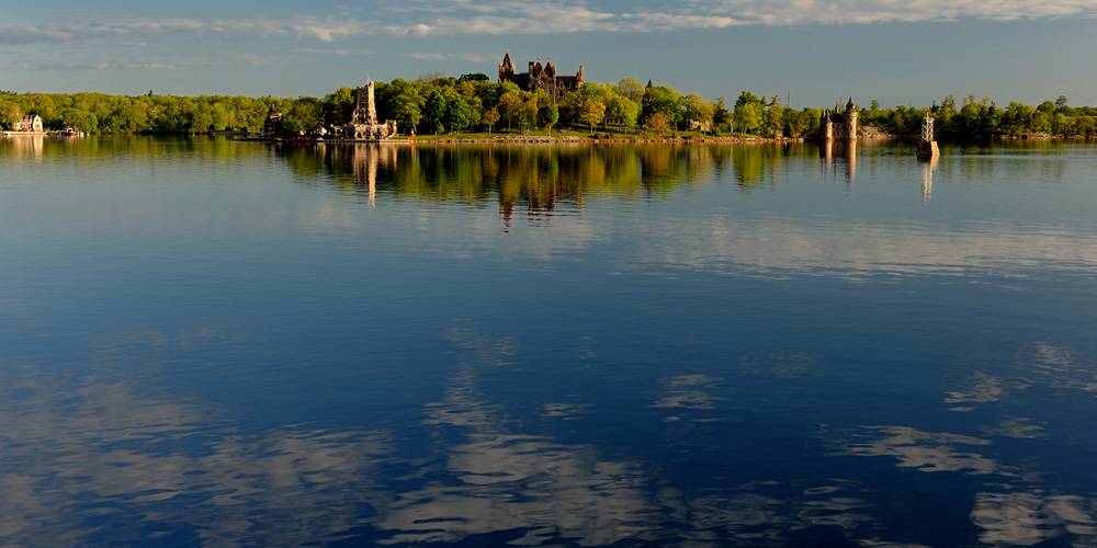
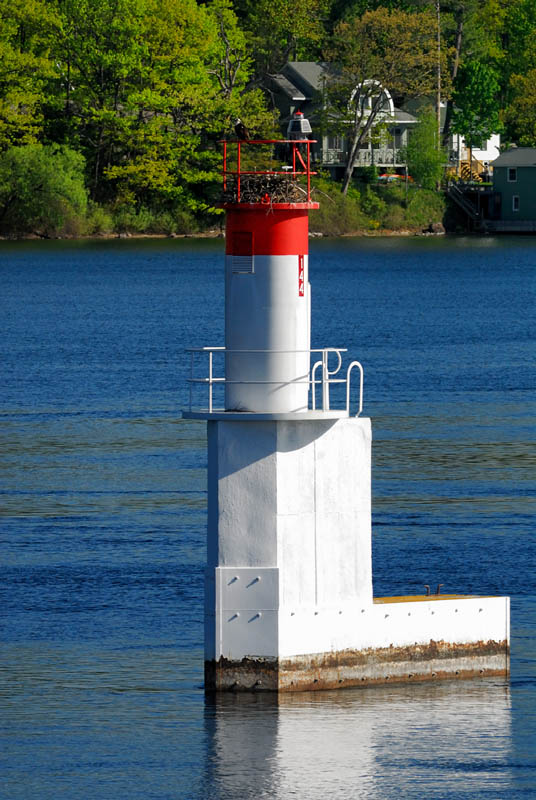
The view I had of Boldt Castle at twilight is shown to the left above. The view of Sunken Rock is directly above. Although the shot above was a 60 sec exposure the waters of the river weren't still enough to catch much of a reflection of the green light that now shines from the lantern room to mark the channel and to warn mariners from the navigational hazard that Sunken Rock stands atop. The view of Boldt Castle on the right was shot Sunday morning when the river was about glass smooth... Click any of the images for a larger view...
|
|||
|
|
|
|
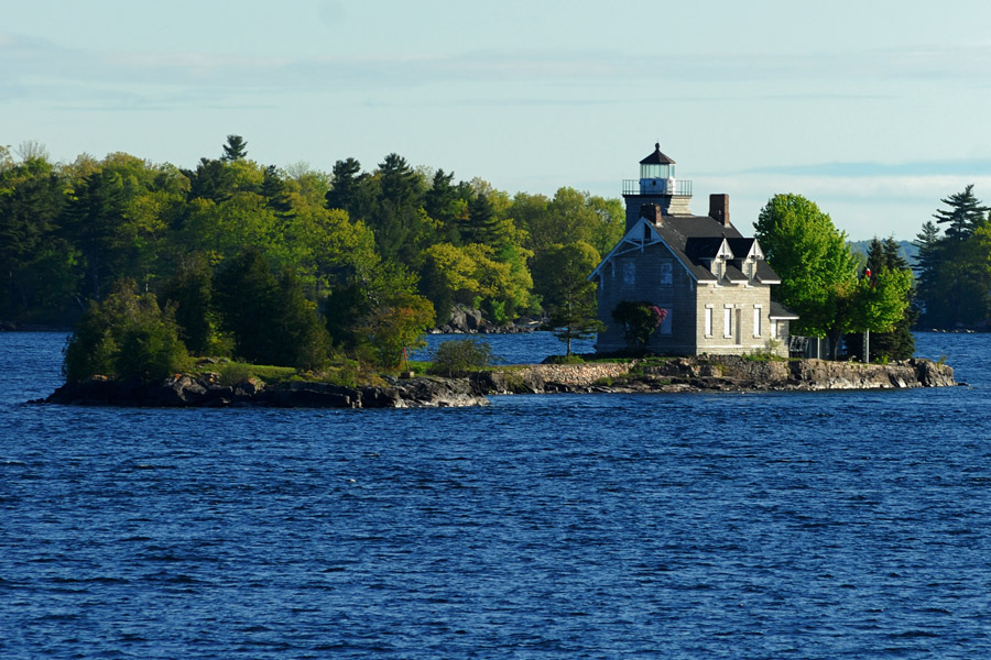
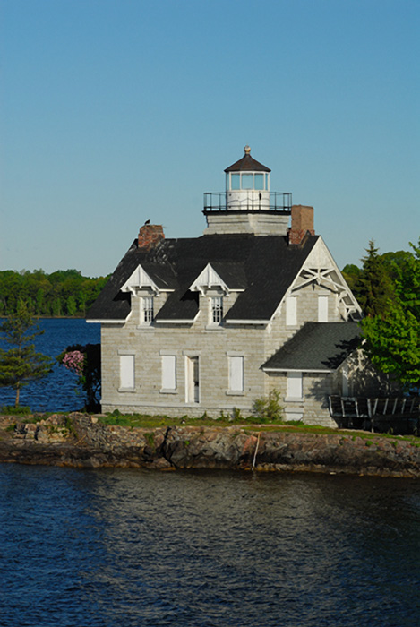
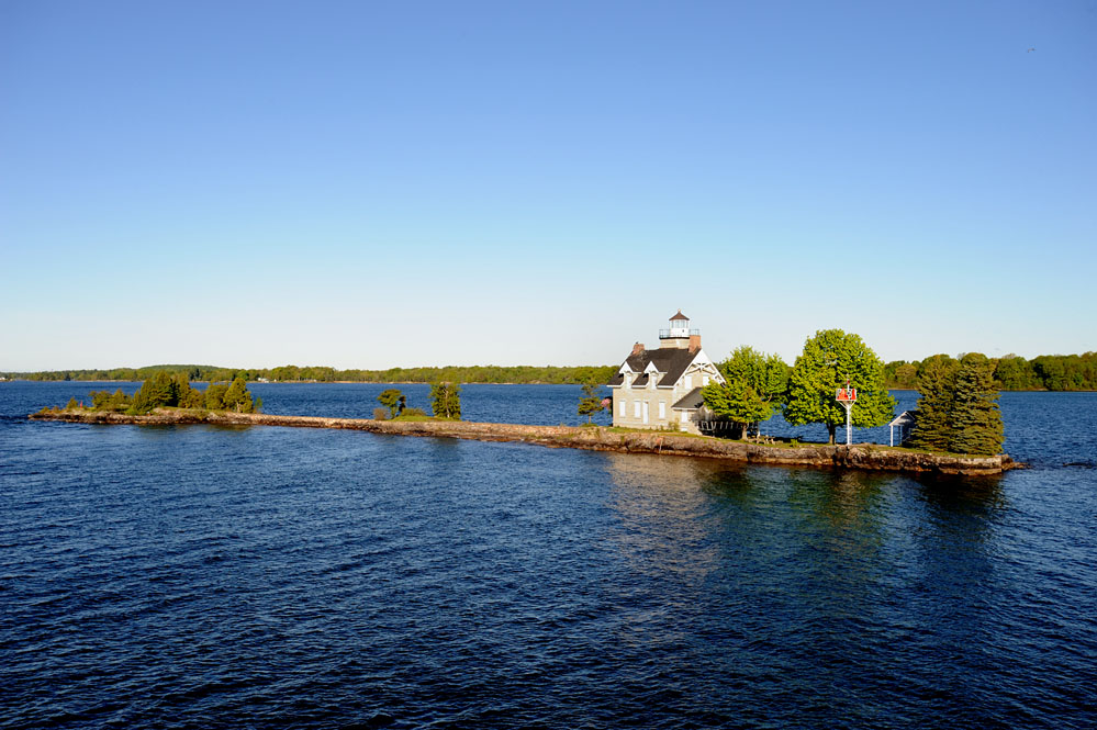
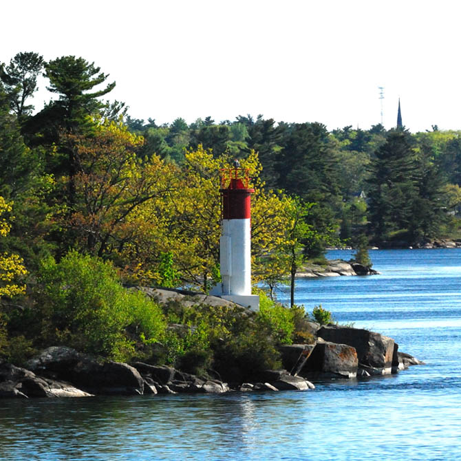
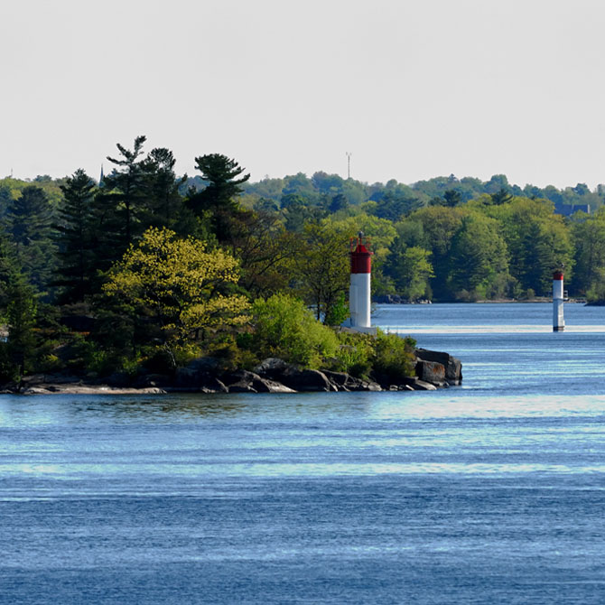
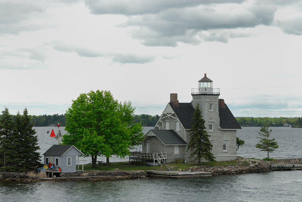
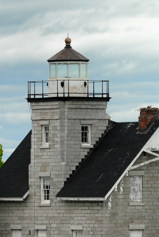
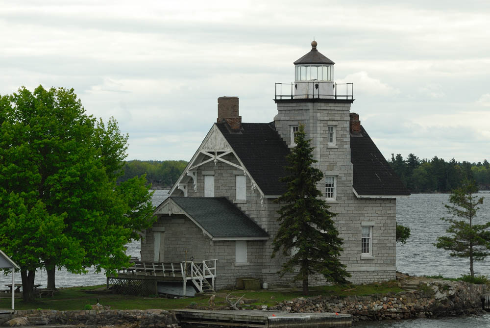
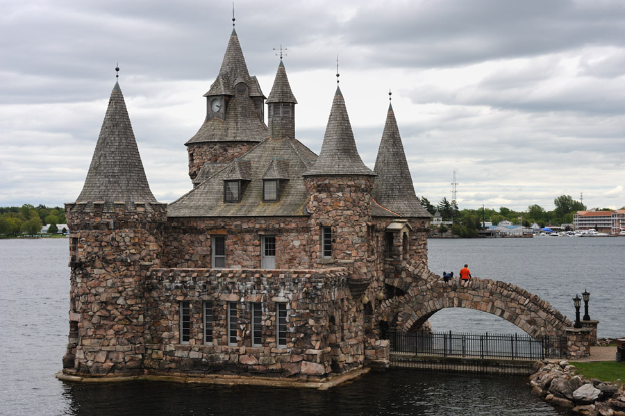
From Sunken Rock just above, which is but a stone's throw from Boldt Castle, we sailed down river in the direction of Sisters Island. Sisters Island stands in the river midway between Boldt Castle and Singer Castle. As I noted above, this region is known as the Thousand Islands... in reality, there are more than 1800 islands in this segment of the St Lawrence River They range in size from very large like Wellesley Island to tiny little islets. Some of the tiny ones still have small summer homes clinging atop them. Sisters Island at one time was actually three small islands spaced very closely together. They have since been connected together and now comprise a single island. Sisters Island is also one of those lighthouses that is almost impossible to photograph from land without resorting to a 1000 mm lens from a very few vantage points that give a view of the island the are publically accessible. The left chimney of the lighthouse as seen in these photos is presently home to an osprey who was sitting on the nest when we cruised by.
|
|||
|
|
|
|
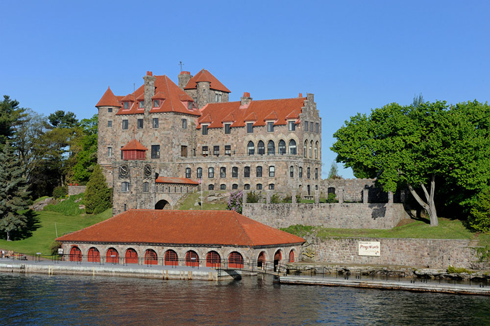
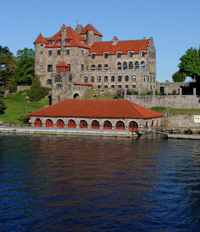
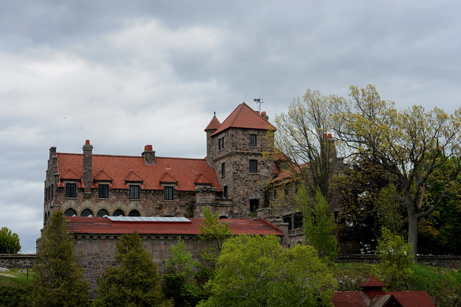
Continuing down river the next major structure to be seen is now known as Singer Castle on Dark Island. This spectacular edifice was orignally built as a hunting lodge by Frederick Gilbert Bourne, the president of the Singer Manufacturing Company (think sewing machines!). Obviously those folks did things on a much different scale than the people that I typically hang out with! The island sits just a few yards to the south of the US-Canadian border and during prohibition, as you might suspect, the island was used for rum running! The castle has been extensively restored and is now open for visitors to tour.
|
|||
|
|
||
The next lighthouse going down river is Crossover Island. The island stands on a small island that defines the north side of the shipping channel at this point in the river. The lighthouse was built in 1848. This island is named for a point in the river where ships cross between the American and Canadian channels. Children raised on the island when it was an active lighthouse had to be rowed to land to go to school by their father the light keeper across the 3/4 of a mile that separates the island from the American shore. The lighthouse is now privately owned and can be seen from a point along Route 12 a little to east of Chippewa Bay. When we passed by the light in the morning going down river, the sky was beautifully clear and there were spectacular reflections in the river. A couple of hours later headed upbound, the sky had clouded over, which is typical of the changeability of the weather in the Great Lakes from my ten years living in Michigan from 1996-2006. Some photos of Crossover Island in the afternoon are in the second row below... Notice that the weathervane atop the lighthouse also very quaintly sits at somewhat of an angle
|
|||
|
|
|
|
|
|
|
|
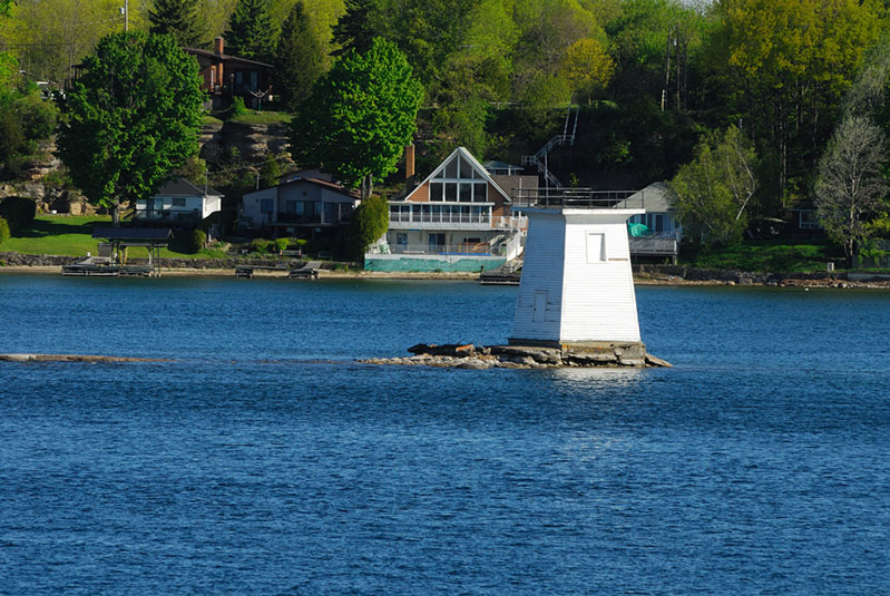
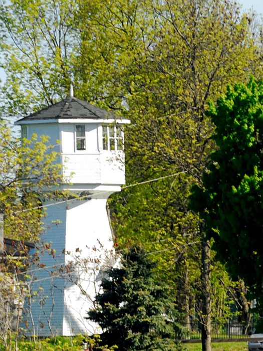
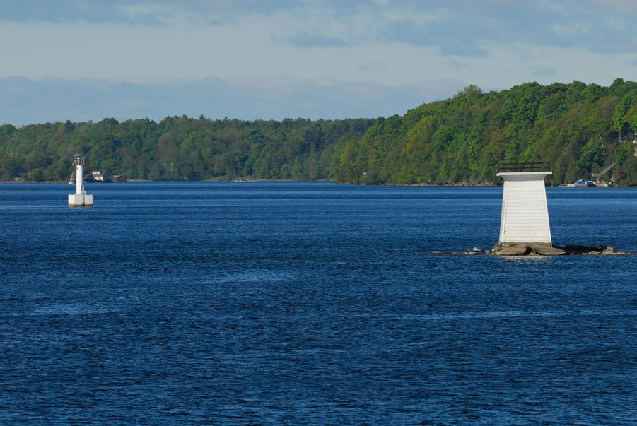
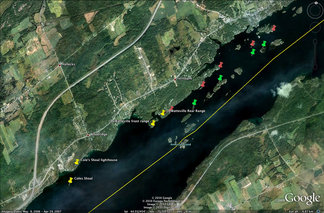
When we had passed down river of Crossover Island, that is exactly what our course did... we crossed over to the Canadian deep water channel. We next came to Cole's Shoal, which is now a square wooden pyramidal tower standing on a foundation built on one of the rocks that comprise the shoal. Somewhat upriver by a few hundred yards is a modern tower that replaced the wooden tower as an aid to navigation. Up on the hillside beyond the shoal light is the Cole's Shoal lighthouse which has an octagonal wooden lantern room.
|
|||
|
|
|
|
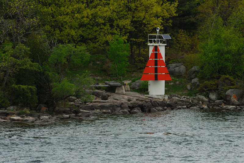
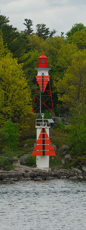
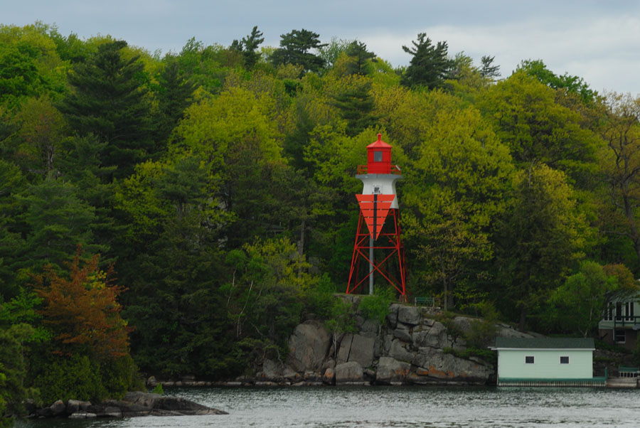
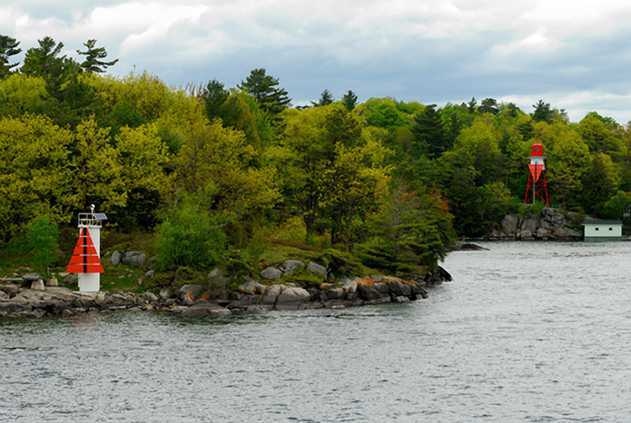
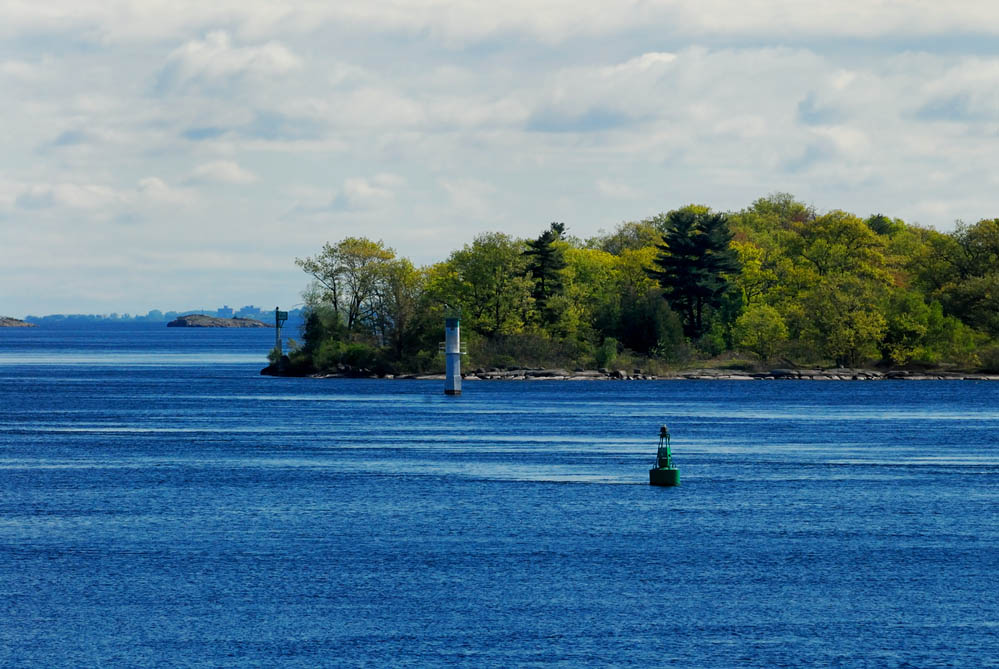
Beyond Cole's shoal, we approached the DeWatteville Range Lights. The map below shows the location of the range lights and the deep water channel that has numerous channel markers lining both sides to insure that ships navigating the channel don't stray from it onto the rocky shores on either side of the channel. If you recall the pnemonic "right red returning" then the sense of the locations of the channel marker in red and green in the map below will make sense. Note, not all of the channel markers are flagged with red and green push pins on the map below... only those that I can discern the locations of from the photos that I shot as we transited the channel...
|
|||
|
"In the channel"
|
|
|
 |
 |
||
|
|||
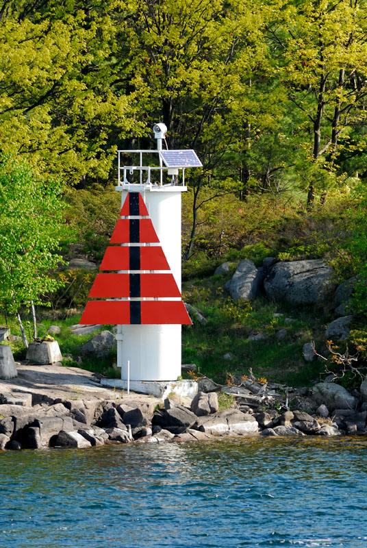
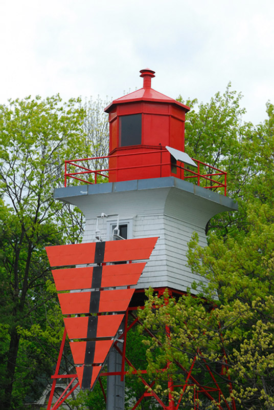
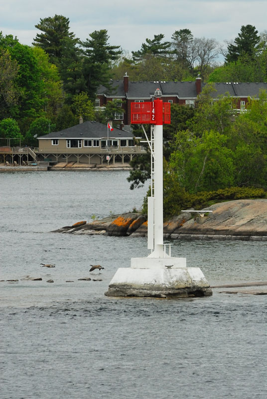
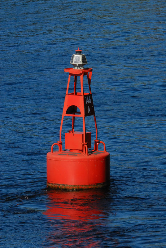
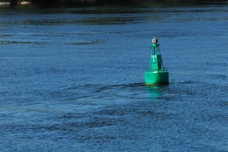
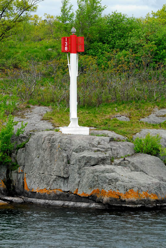
The group of photos above shows the DeWatteville range lights. These lights were first established in 1927. The front range light was built on the south side of DeWatteville Island and was originally a circular tower with a red daymark on the upper portion of the tower. In 1992 it had the distinctive orange triangular daymark added with the vertical black stripe. The focal plane of this light is 19.5 feet. The rear light is a red square skeletal pyramidal tower 35 feet tall with an enclosed white wood service room below the red cast iron ciruclar lantern room. The focal plane is 68 feet. It too had a fluorescent orange trianglar daymark added in 1992; the rear tower's triangular daymark is inverted relative to the front tower. When a ship is in the channel, as shown in the center photo above, the two black stripes are vertically aligned and the triangles are point to point. The photo immediately above shows the relative location of the range lights along the shore of the channel. Photos of some of the channel markers along the segment of the Canadian deep water channel are shown below.
|
|||
|
|
|
|
|
|
|
|
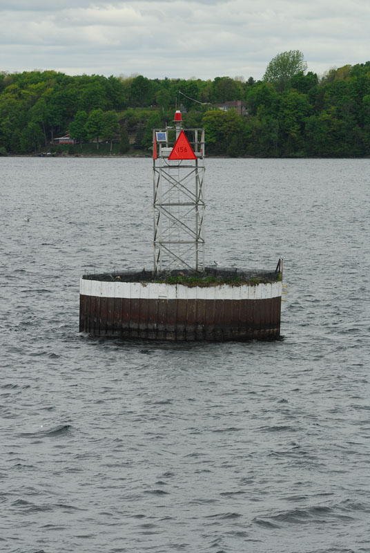
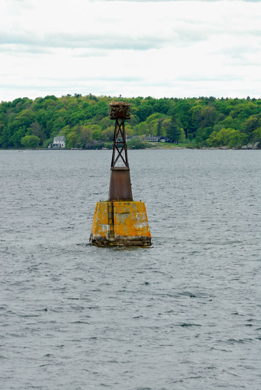
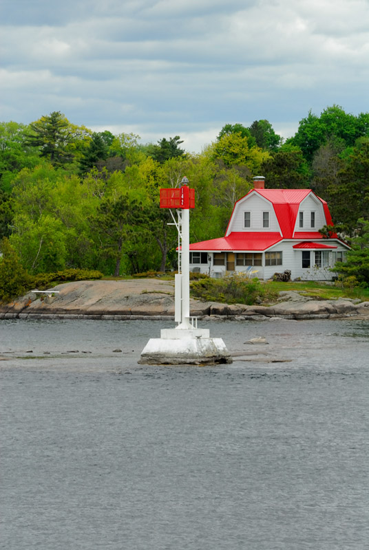
This is the view looking over the stern of our vessel back up the Canadian deep water channel. You can see how heavily lined with channel markers this segment of the river really is. The channel markers come in every description imaginable and many come complete with osprey nests!
|
|||
|
|
|
|
|
|
|
|
|
|
|
|
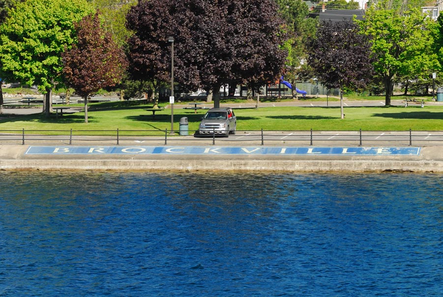
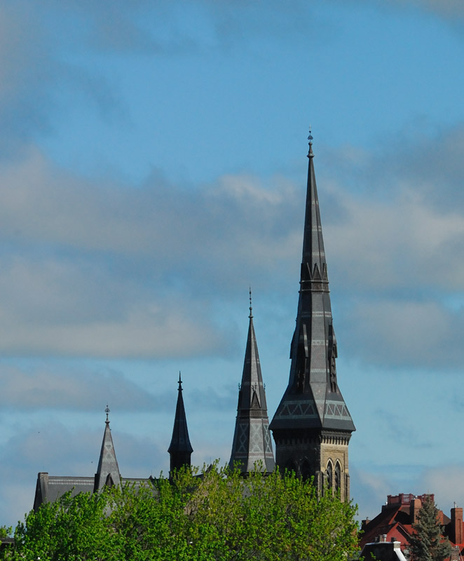
Continuing down the river we next passed Brockville. There have been so many commercials on US television advertising the number of "bars" you get for cell phone reception with various cellular carriers that I couldn't resist the shot below to the right... "I've got four steeples!"
|
|||
|
|
|
|
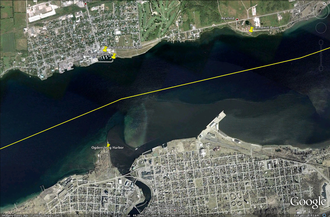
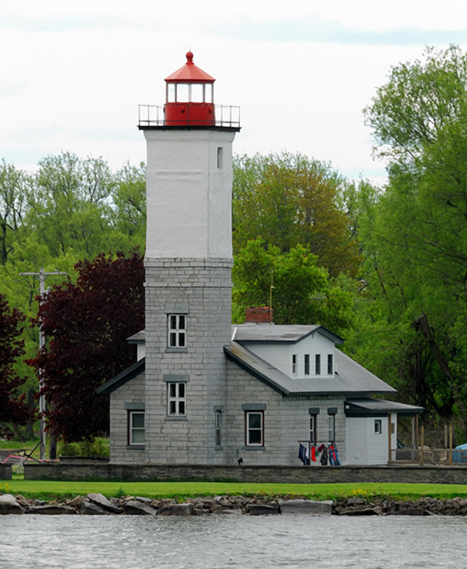
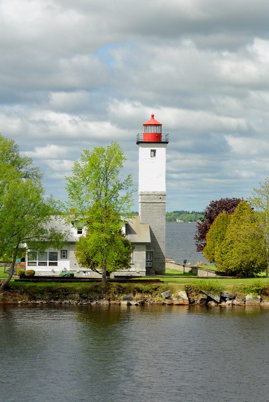
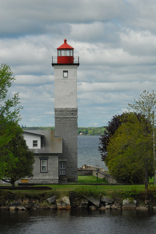
Below Brockville, we crossed the river back to the American side to make our way to Ogdensburg. I've photographed this light before from a city park across the Oswegatchie River from the lighthouse, which is at the end of a private road. You get a sense for why the light was located where it is... as it is surrounded by very shallow water as you can tell from the Google map shown below.
|
|||
|
|||
|
|
|
|
Just slightly down river and across from Ogdensburg stands the Windmill Point lighthouse. Originally, this structure was built as a windmill in the 1820's and a battle for it was fought there in 1838. The stucture was converted to a lighthouse in 1872 and served as one until 1978. For those visiting this area who have their passport with them, it's worth crossing the river at Ogdensburg and going down to visit Windmill Point and the nearby lighthouses in Prescott. It was quite interesting to get to see Windmill Point and the two lights in Prescott both from land and from a mariner's perspective on this trip.
|
|||
|
|
|
|
|
|
|
|
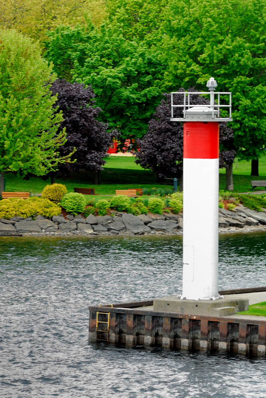
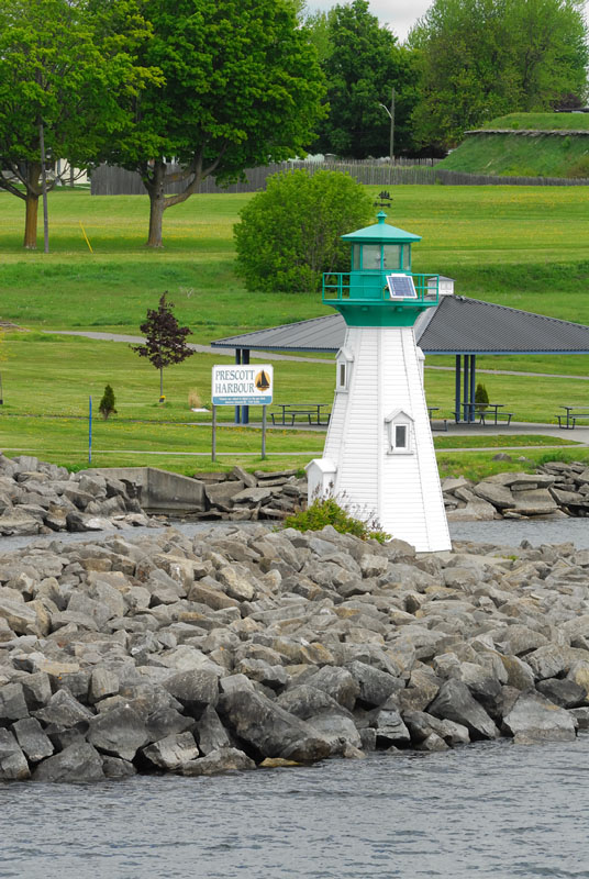
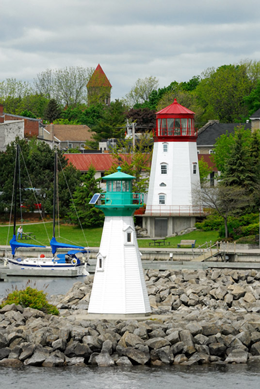
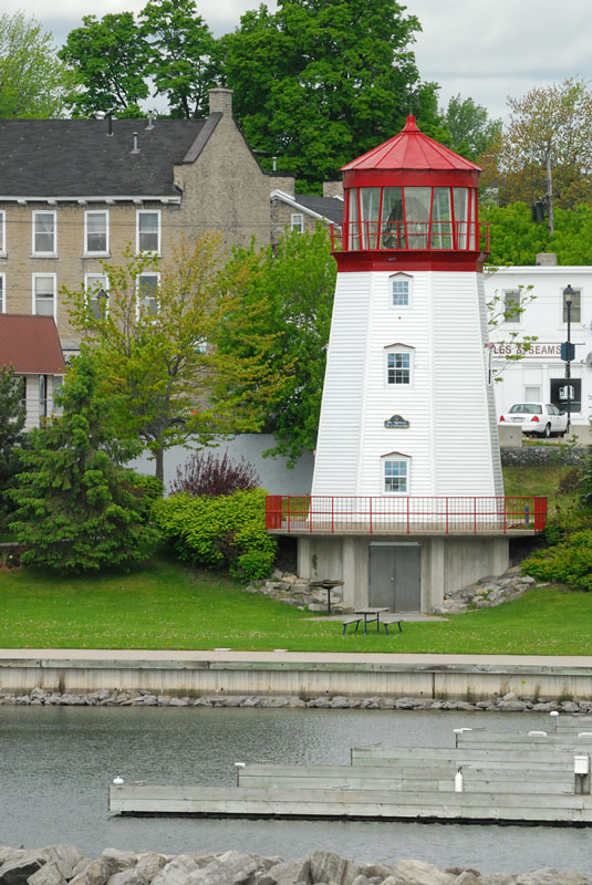
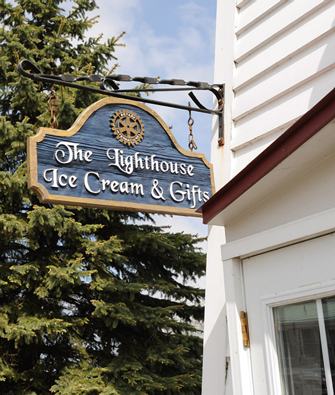
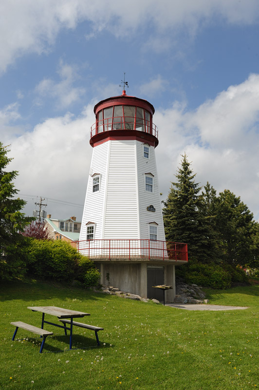
Prescott is the home to two lighthouses. The acutal lighthouse is the Prescott Heritage Harbor light which marks the entrance to the Prescott marina. The other light is the Prescott Rotary Light. It is a replica and was built by the Prescott Rotary Club. The later serves as a visitor center for Prescott as well as an ice cream stand and gift shop in the summer. The lantern and lens of the Prescott Rotary light, however, are both real. They were a gift of of the Canadian Coast Guard from the old Dominon Lighthouse Depot. The lens was used for training purposes by the Canadian Coast Guard. The depot was located on King Street West where the Coast Guard base is now located.
|
|||
|
|
|
|
|
 |
|
|
From Prescott, our journey went back up river headed now for Rock Island lighthouse on the far side of Alexandria Bay. Going upriver, we got to see the opposite sides of some of the lights as well as Singer Castle from Canadian waters. The day had clouded over significantly since the clear blue skies of the morning, which gave a much different perspective to some of what we saw on the way up river. Since I included a very large number of images of the transit through the deep water channel near DeWatteville Island, I won't repeat that here. I did show some cloudy afternoon photographs of Crossover Island above but there are some additional shots below.
|
||
|
|
|
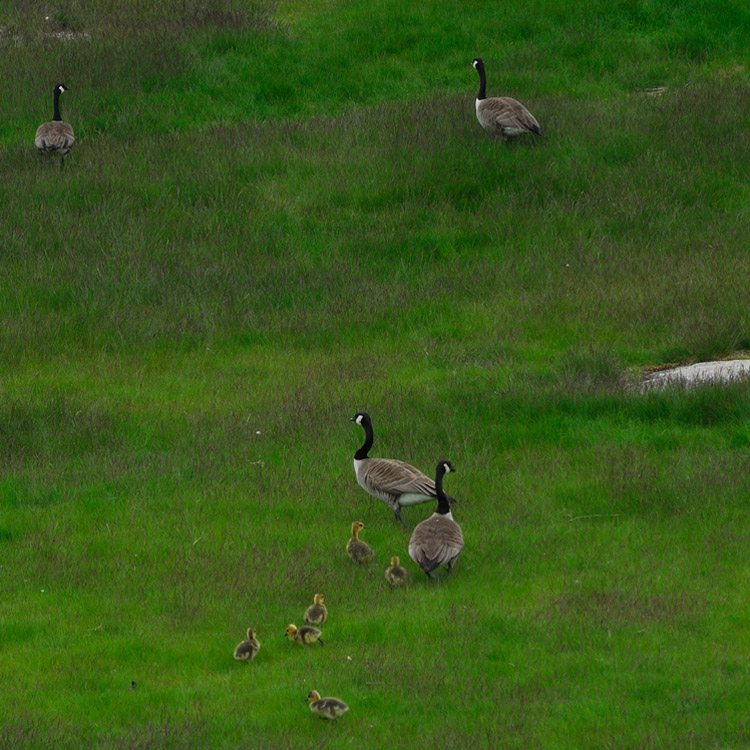
Going upriver gave a completely different perspective to Crossover Island. There were also some Canada geese in the front yard with what appeared to be some very recently hatched goslings...
|
||
 |
 |
Continuing down river we went past Singer Castle again on the Canadian side of the island. Going down the river with the sky clouded over, the island seemed to have somewhat of a sense of foreboding...
|
|
|
|
Beyond Singer Castle, we went by the Sisters Island lighthouse on the Canadian side. The sky was heavily clouded by this point in the day but there was tremendous texture in the cloud bottoms that made for interesting compositions nonetheless...
|
||
 |
 |
 |
|
||
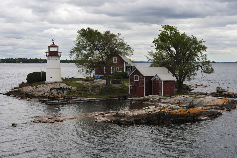
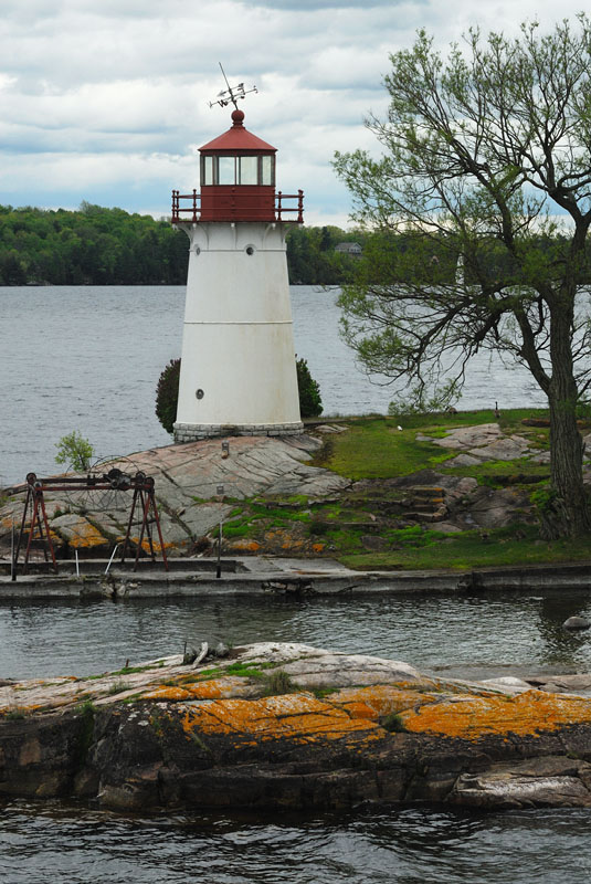
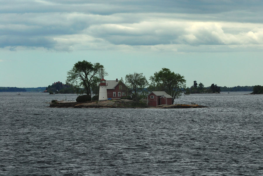
While cloudy, overcast days aren't the most cheerful, from a photographic standpoint, the light is very even and when the clouds have texture, images made on cloudy days can convey mood and personality that just isn't possible with clear, blue sky days... The images of Sunken Rock below have a completely different personality from those shot the first thing out of marina the morning of the trip. Which do you prefer?
|
|
|
|
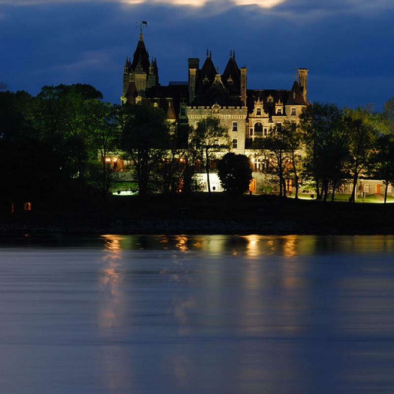
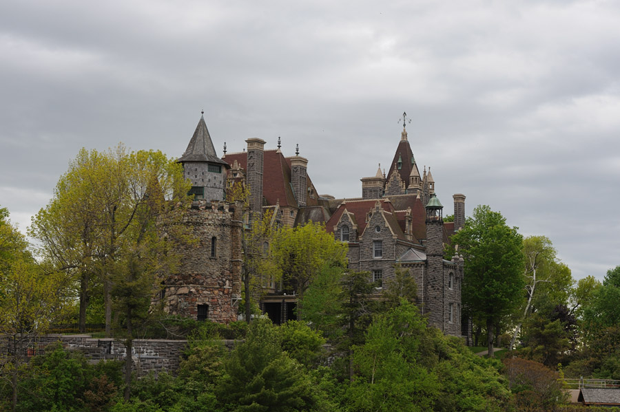
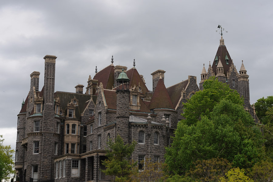
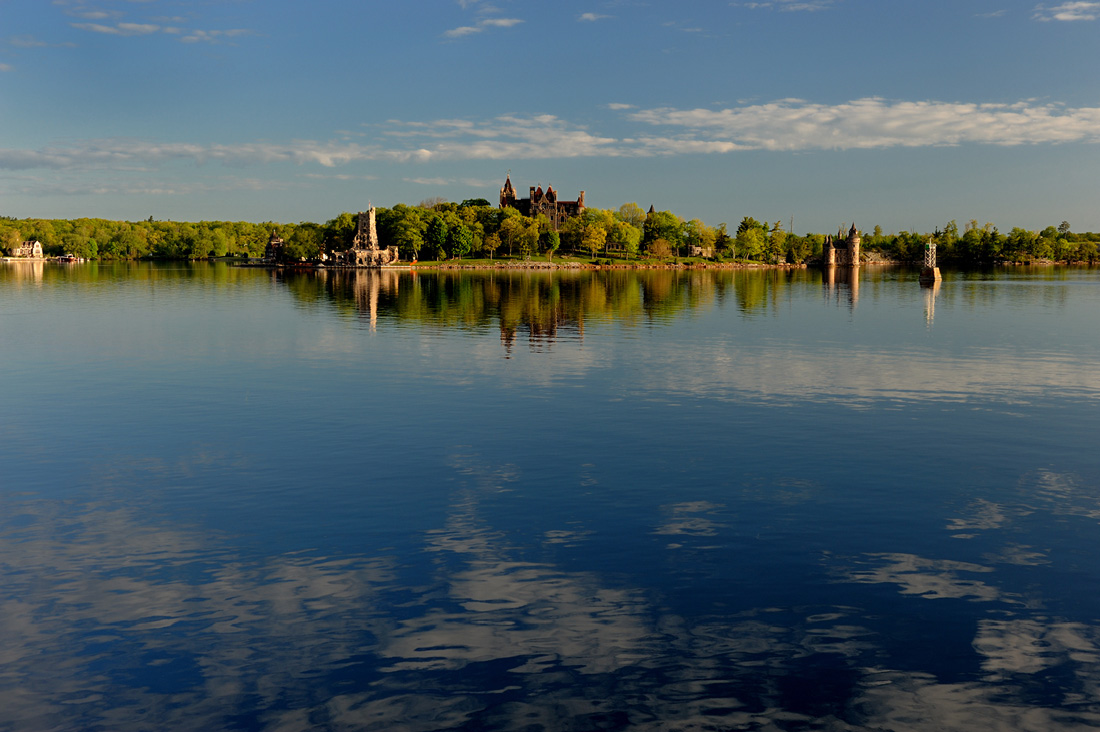
Boldt Castle stands on Heart Island directly across from the Marina at Alexandria Bay. Alster Tower George Boldt, the proprietory of the Waldorf Astoria in NYC and the Bellevue-Stratford Hotel in Philadelphia and his family spent several summers in a cottage on Hart Island (the original name and spelling). During that period, they greatly expanded the original cottage. In 1900, the Boldts embarked on a project to build the huge structure that now stands on Heart Island. Four years into the project, construction of the magnificant edifice was abruptly halted following the death of Louise Kehrer Boldt due to tuberculosis (then referred to as "consumption"). For the following 73 years, the uncompleted structure was left to the elements. The Thousand Islands Bridge Authority acquired the property and the nearby yacht house for $1 under an agreement that all revenues obtained from the property would be used for its restoration so that the island could be preserved for future generations. The island is now open to the public and regular ferry service runs between the marina in Alexandria Bay and the boat terminal on the north side of Heart Island. The image top left below is the only part of the estate that was ever used by the Boldt family. That was the children's playhouse and was used by the Boldt children while the rest of the house was being constructed.
|
|
|
|
 |
 |
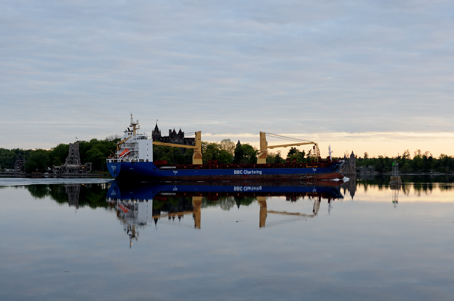
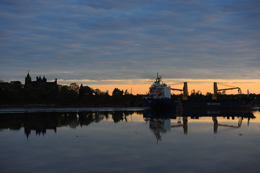
Fast forward about 12 hours... While I was generally quite happy with the images of Boldt Castle shot from the boat on Saturday afternoon, there was no portend of what was to come at dawn the following morning... I awoke to the distant deep sound or maybe it was the vibration, of a large vessel. When I jumped out of bed, for whatever reason, I grabbed a camera and went out onto my balcony. The BBC Alaska was downbound, slicing through the glass smooth waters of the St Lawrence... |
|
The image just below was shot 30 to 60 seconds after the image above and was shot without readjusting the exposure... I was shooting in full manual mode with a Nikon D3 with a Nikkor 17-35 mm f/2.8 lens mounted on the body.
|
Just before the BBC Alaska made the Sunken Rock lighthouse, the sun rose and you can see the first light of day reflecting on her blue hull... Still, the best was yet to come about 30 minutes after the photographs of the BBC Alaska were shot. By then, the St Lawrence had settled down and was again nearly glass smooth. The sun had begun to climb higher into the sky and while the light was still warm, the colors of the sunrise had begun to mute. When I walked back out on my balcony, it was greeted by the spectacular reflection shown below.
|
I shoot a lot of landscape photographs, including a great many reflections. I also shoot a lot of cloudscapes. This is the only time that I can remember ever having the opportunity to shoot a reflection of the clouds on such still water as in this image. OK, rewind about 12 hours... back to the trip up river beyond Boldt Castle. |
|
|||
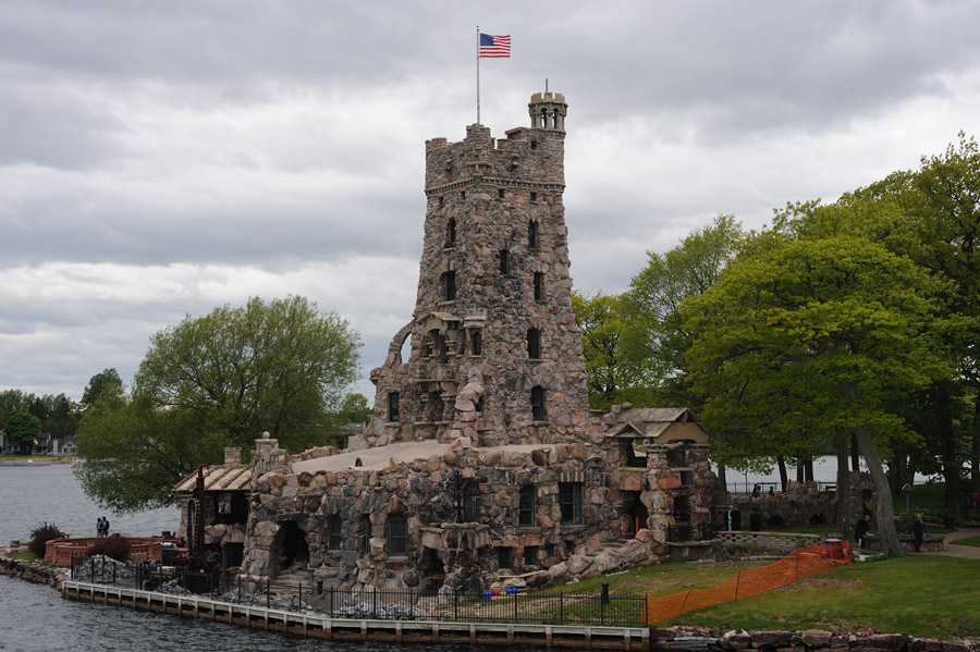
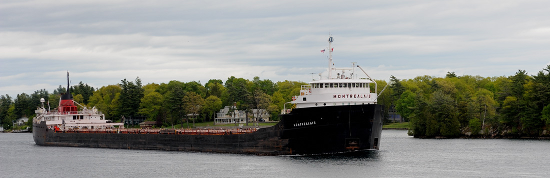
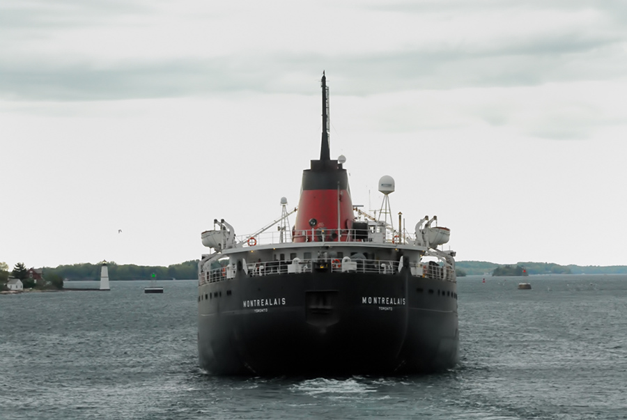
...we continued upriver beyond Boldt Castle, the captain took us through some of the circuitous channels that lead by some of the mansions built by the wealthy in the first half of the last century -- what is now known as millionaire's row. As we made our way upriver, we were overtaken by the Montrealis. Our captain pulled into an inlet to allow the very much larger Montrealis to pass us so that we would be able to maneuver when we arrived at the Rock Island lighthouse. The image to the left below shows the Montrealis about to pass the Rock Island lighthouse which is off the port side of the ship.
|
|||
 |
|
 |
|
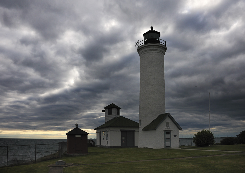
Following the photo stop at Rock Island, we headed back down river to the marina at Alexandria Bay. From there, I jumped in the car and drove out to Tibbetts Point in the event that the edge of the storm clouds overhead would come up off the horizon. It didn't but there were still some dramatic sky images to be had nevertheless!
|
|||
|
|
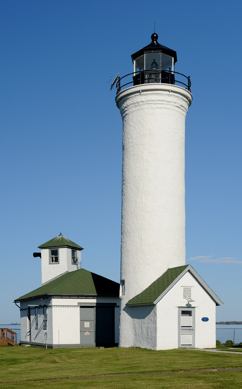
The two images above were some of what I shot that evening at Tibbetts Point. The sky was turbulent and the clouds heavily textured. Contrast the images above to those shot the following morning at Tibbetts Point about 12 hours later... Lake Ontario was calm with virtually no waves... the sky was clear and blue. Perhaps the perferred view for some but personally, I prefer the stormy weather images above to the peace and tranquility inherent to those below!
|
|
|
|
 |
 |
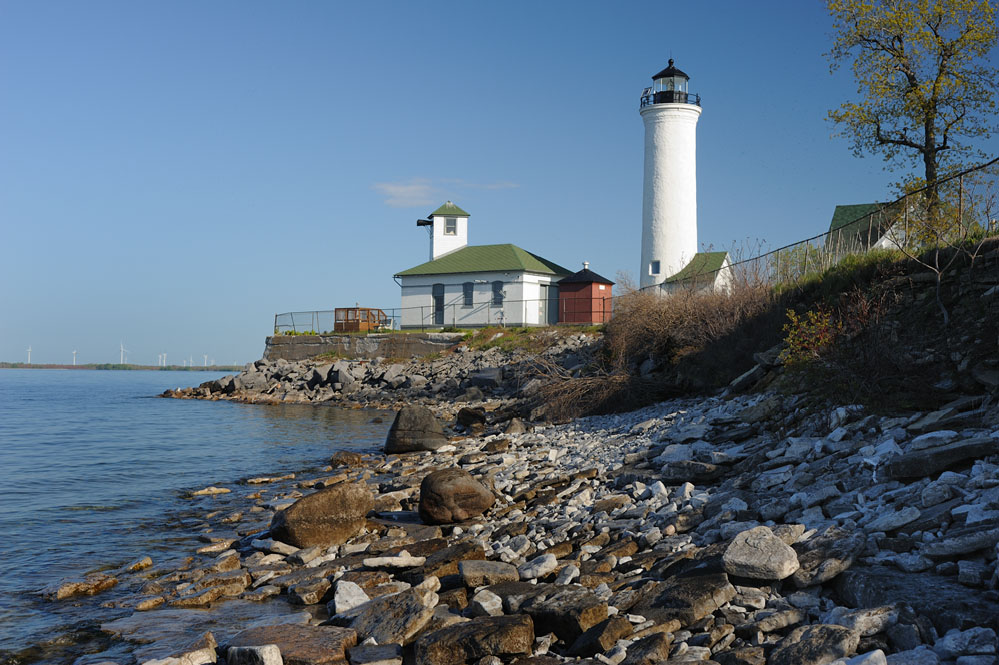
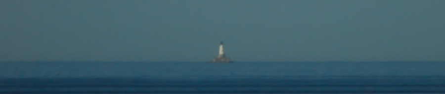
Fifteen miles out on Lake Ontario stands East Charity Shoal lighthouse. There is a viewing point at Tibbetts Point but on past visits there, the air had never been clear enough to see the East Charity Shoal lighthouse. The morning I was leaving to head home, it was... at least after a fashion...
|
It was also possible to see the skeletal tower on Pigeon Island that morning but there was too much turbulence in the air to get an even half-way clear image of that light, which is also about the same distance out from Tibbetts Point.
|
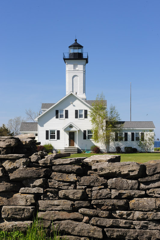
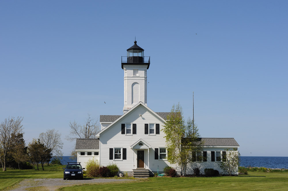
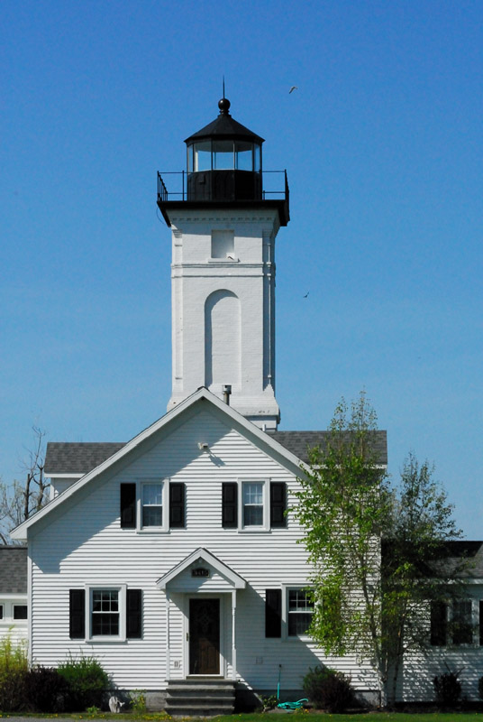
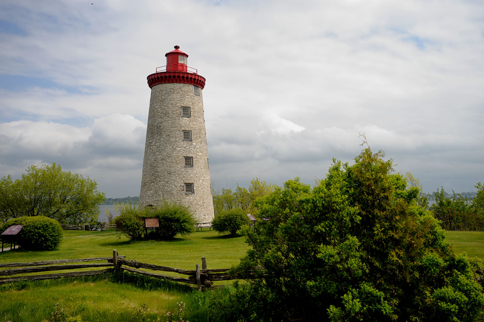
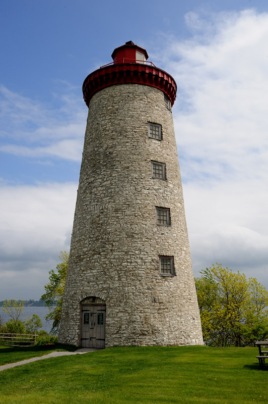
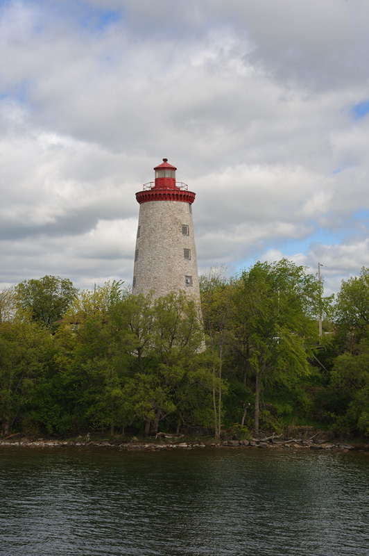
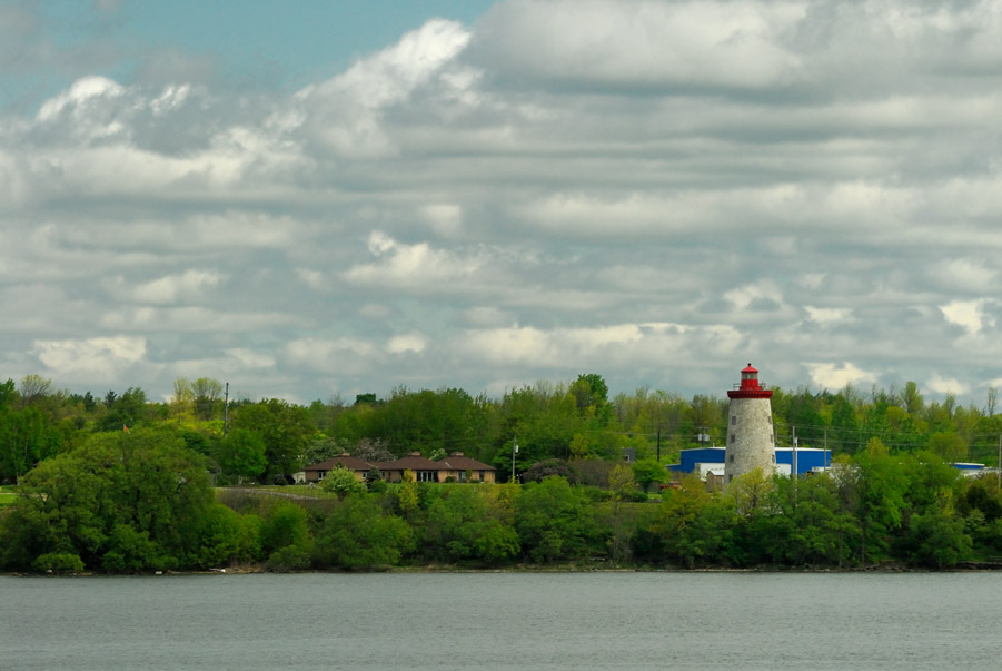
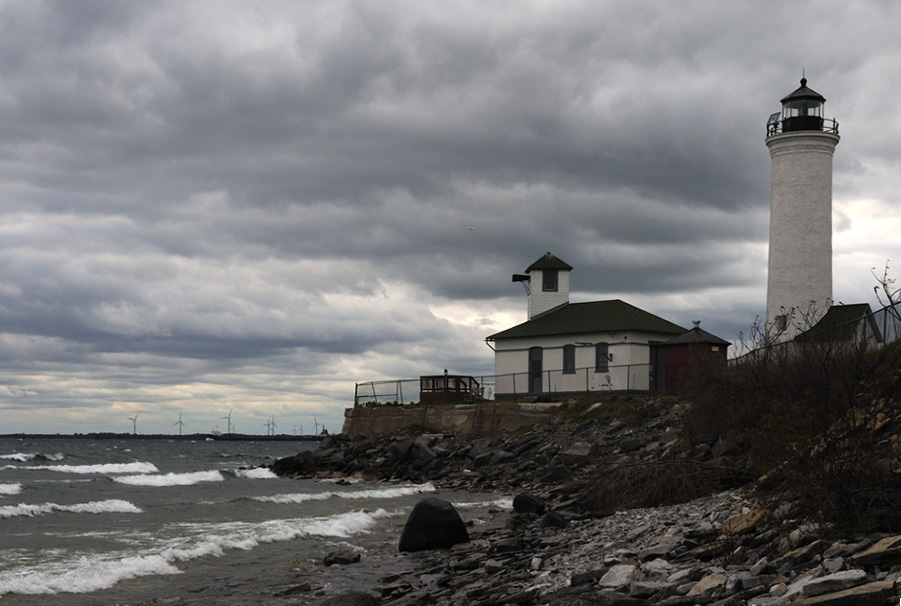
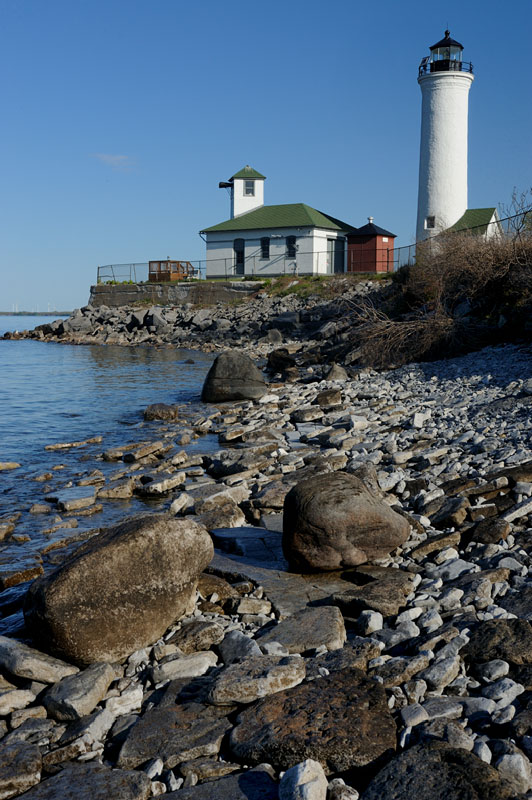
| After leaving Tibbetts Point, I drove southward and stopped at Stony Point as the last lighthouse of my tirp. I've been to Stony Point a number of times but this was the only time that I've ever been there when it wasn't either foggy or raining. | ||
|
|
|